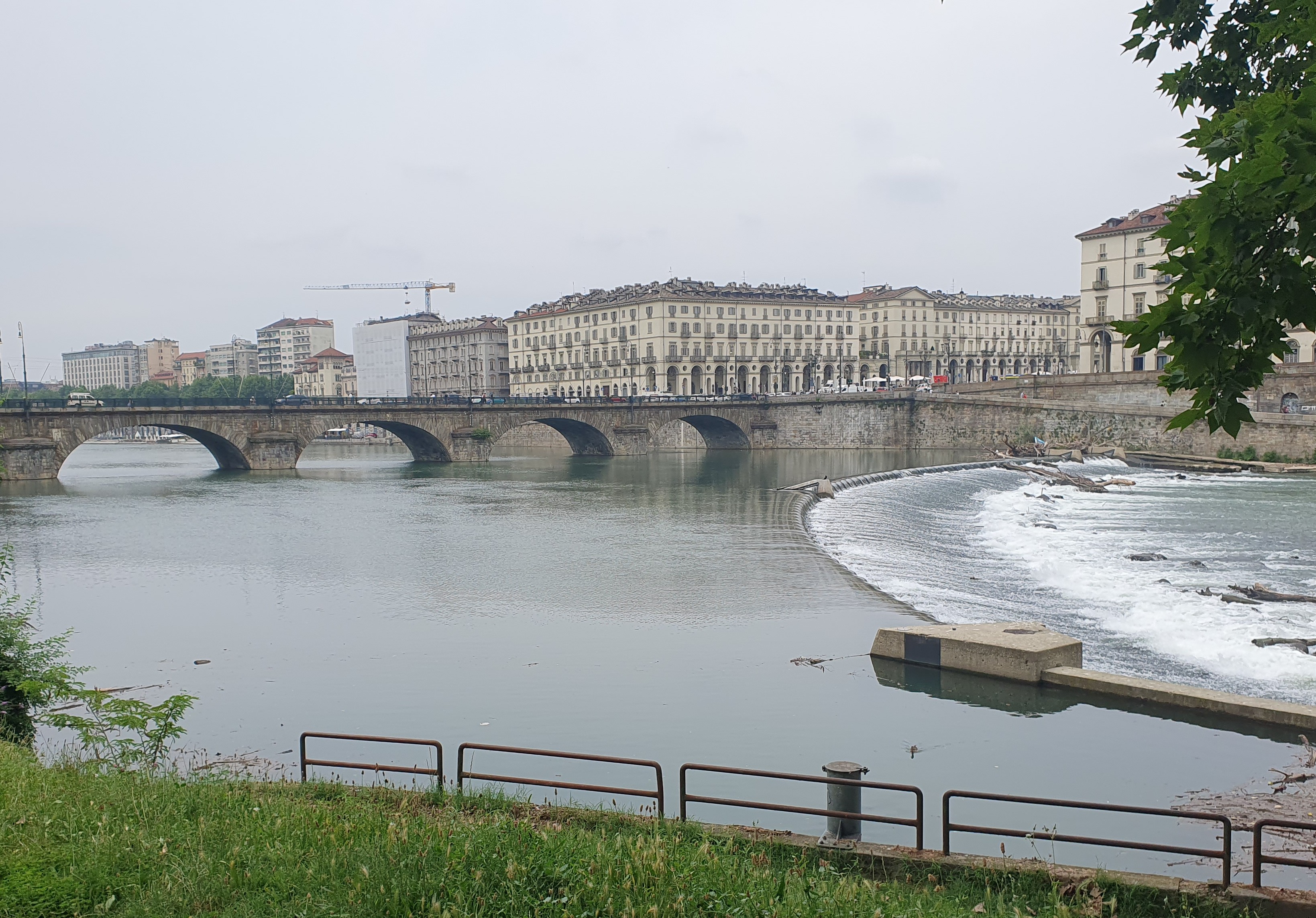
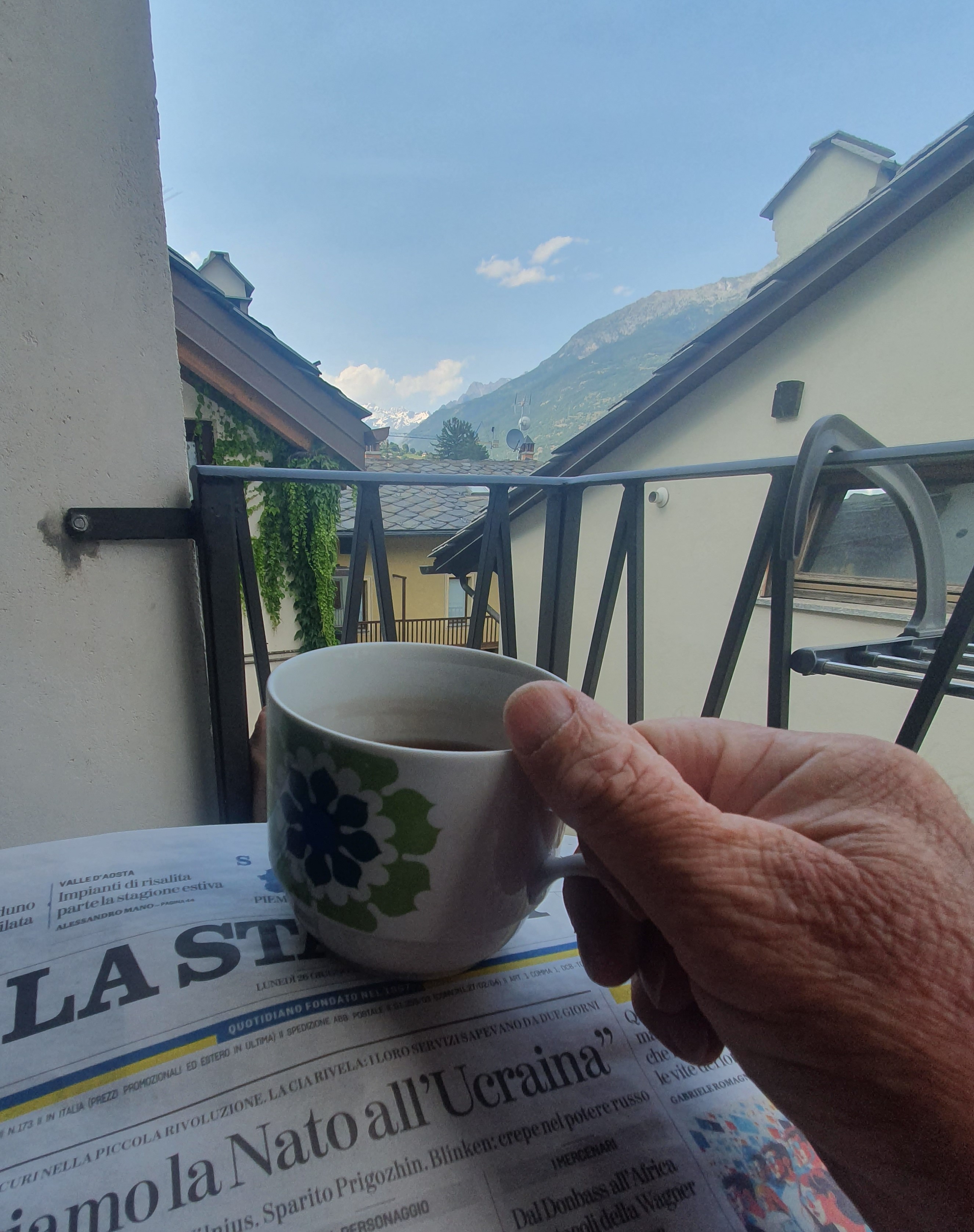
Turin. From some places you can just make out the mountains. Filtered through smog and divorced by distance they float like a hint on the horizon more than a reality. For us reality is not getting skittled: cycling out of Turin feels like an act in a tragic opera: the backdrop may be Baroque or it may be Alpine,

but either way, you just know something terrible is about to happen. And no one is going to clap.
Can I pass this truck without being forced into oncoming traffic?
Oh my god, this ramp is leading onto a freeway!
No, I bicker, we should turn right.
Yes, the Po river flows through the city, strong and fresh from the snow. And we did think that cycle paths along the banks would lead us out quite nicely, but no. False turns, back tracking, ad hoc decisions all lead into aneurysms of traffic in a seeming city of bad choices.
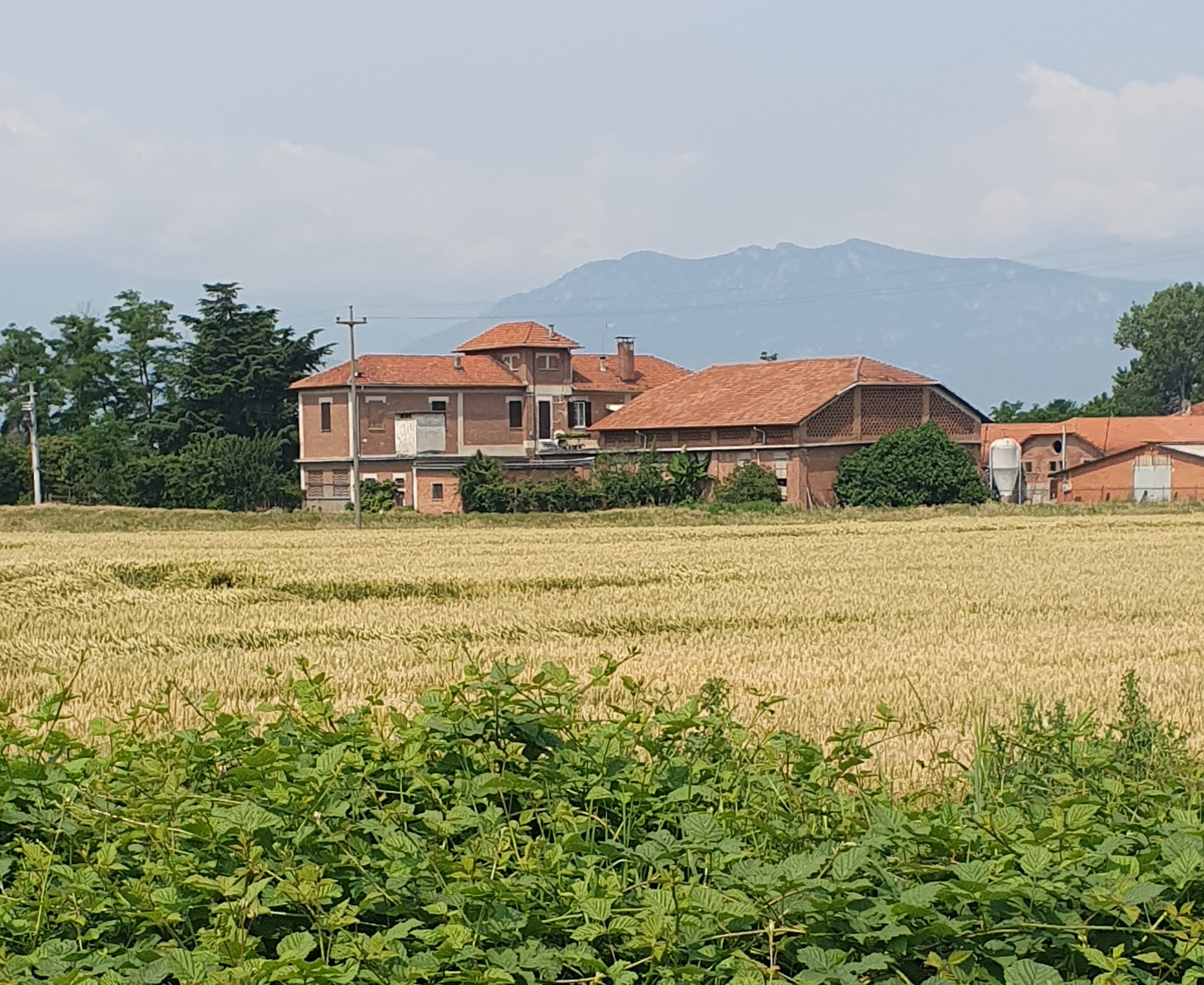
What can you do but keep on riding? Eventually the traffic does resolve into one road leading south, Strada Carignano morphing into Strada Nizza and at last we pick up pace. Corn fields appear. Soon a world of corn as we move out onto the agricultural powerhouse that is the Plain of the Po. The air blast of a passing truck moves out across a sea of stalks, they accept this wave and, nodding, calm it. I breathe easy, put my head down and start at last to just ride.
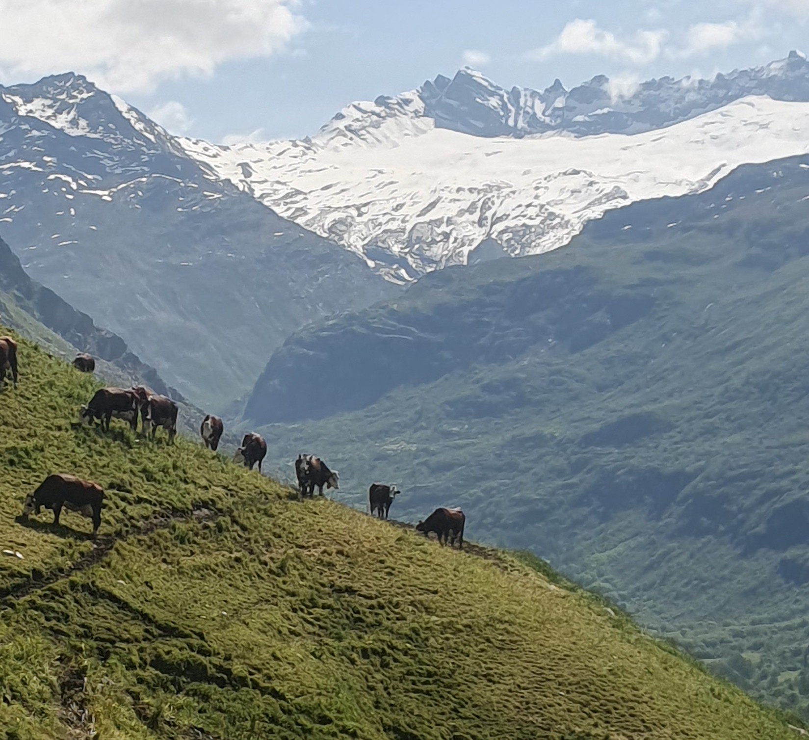
With a laden bike it’s still easy enough to push 30km per hour across the plain, the freedom of movement mitigating the sameness of a dead-flat landscape. We pass through or around interesting towns. The sight of a trellised field is different, for what crop? But always more corn, tall on the deep loam. Again, we see the snows of the mountains, clearer, closer.
Ross is looking after his knee so we stop for a coffee and snack at the friendly Cafe Tiffany, Polonghera. 35km done, halfway. Relaxed staff pleased to chat, a perfect day, sunny in the low 20’s. Much as we look forward to France, it’s just good to be in Italy.
Soon we reach Moretta and start to see a slow rise in the land. Just the hint of it, appearing at first as a shift of crops from green corn to low, blonde fields of wheet.
Turin lay in the low 200’s, here we cross the 300 metre contour: a modest distinction when measured against the ever growing wall of the mountains. We head towards them, and Saluzzo.
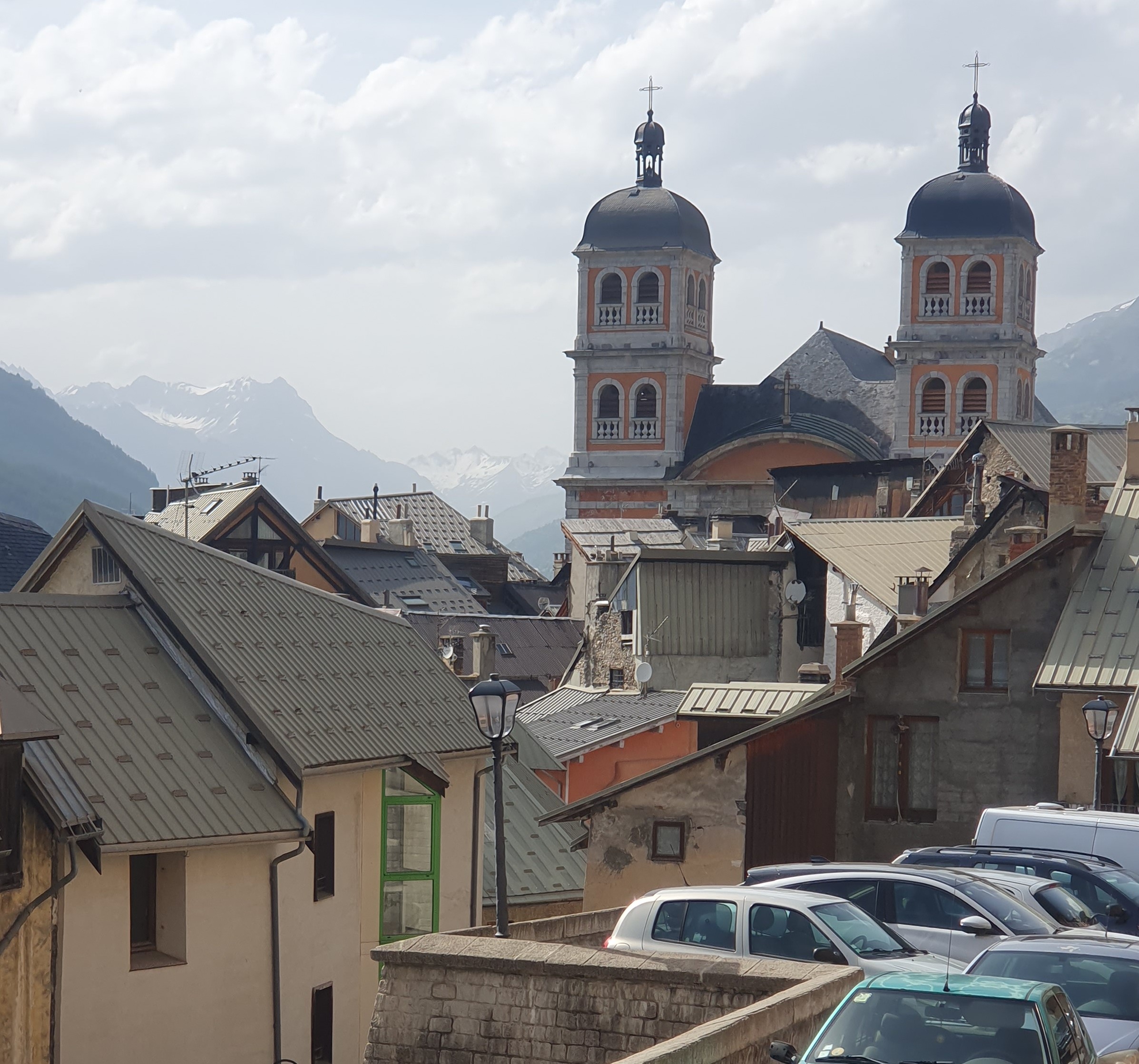
To this point just a name on a map, Saluzzo turns out to be a classic Italian mountain town (medieval leftovers that are often found around the base of mountains, as well as the top). With its city walls and cathedral it would be great to explore. Dismounting, we wend our way through a crowded Saturday market then stop for lunch and a beer at a cafe. Afterwards we decide to just keep going as there’s nowhere really to leave the bikes unattended.
A look at the map indicates that we’re only twelve kilometres short of the Varaita River which will be our route up into the mountains. Though not today because we’ve planned to keep it short in order to iron out any bugs in the bicycles, our packing, or jet lagged selves.

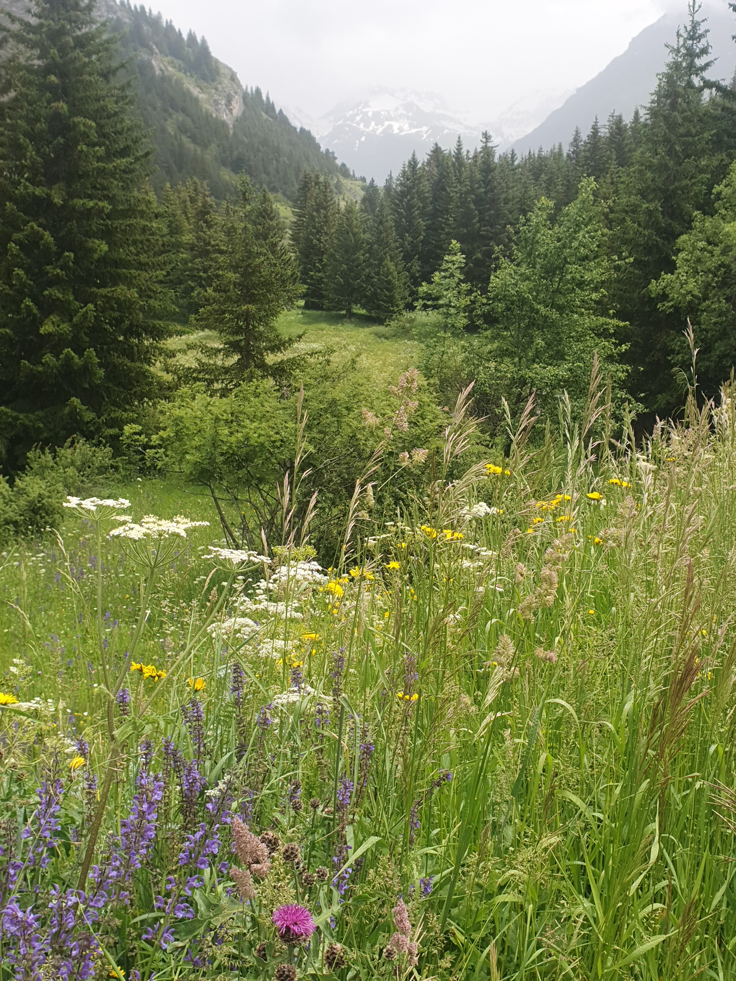
The route through Piasco to Val Varaita proves to be as easy the morning’s ride, if more spectacular with the ramparts of the mountains now climbing away directly to our right. Crossing the river we ride as planned up an adjacent side valley towards the town of Rossana, a couple of kilometres distant. There, although far from obvious, we find the small road that climbs up to the Agricampeggio Monviso and head on up through the forest.
Although not much more than a hundred metres vertically, this proves to be quite an ascent, steep, winding, with every approaching corner promising an easing in the gradient only, in classic cycling fashion, to reveal instead an even more brutal gradient waiting around the bend.
By the time we wobble up to the modest clearing which is the campground, Ross is less than convinced about my choice of venue. However, welcomed by the family who own it, provided with a beer and given the run of possible tent sites, we

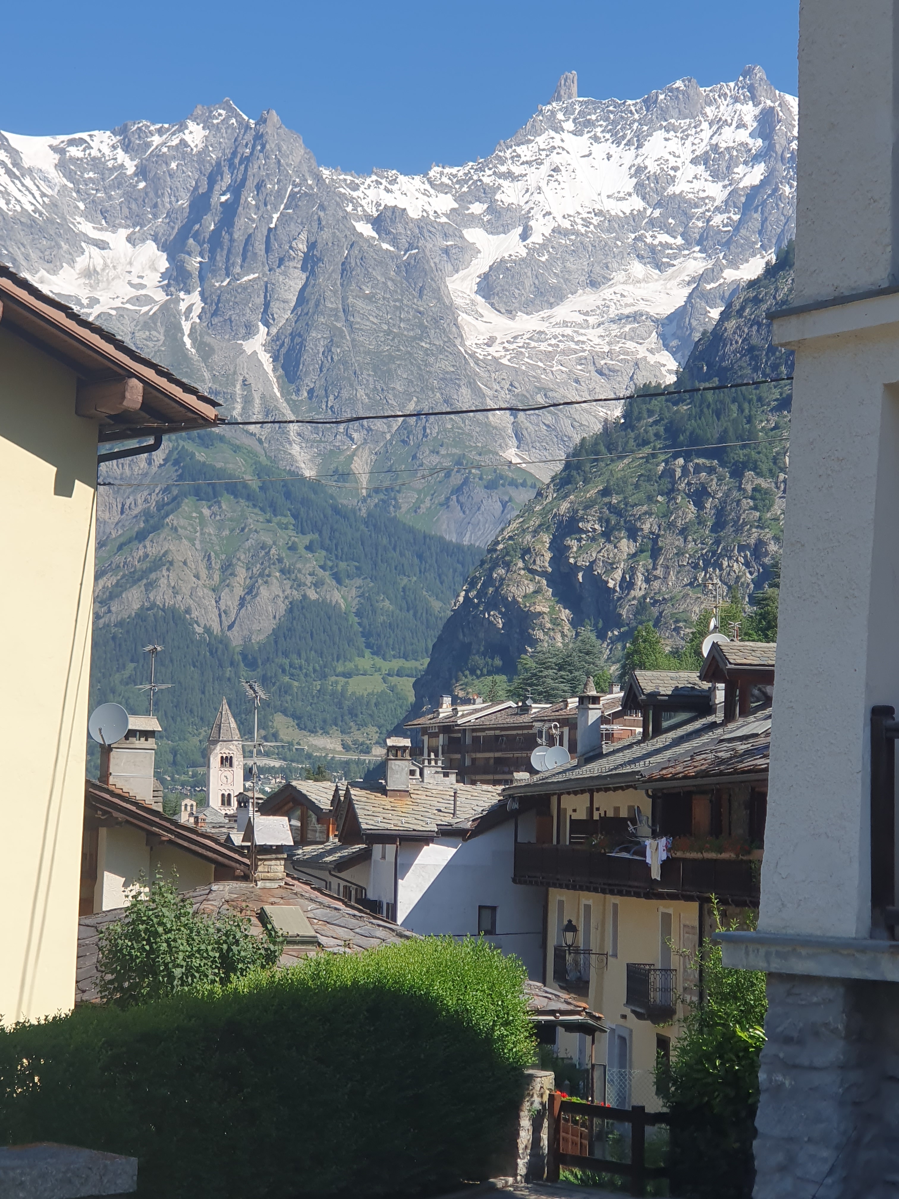
start to see why it has such good reviews. Choosing a spot next to but not under a heavily laden mulberry tree we set up camp, eat mulberries and take it easy, then wander down a footpath in the evening to check out Rossana and find a place to eat.
In its mountain location, it is a pretty little town. The 600 year old frescos gracing the front wall of the local church give us something to
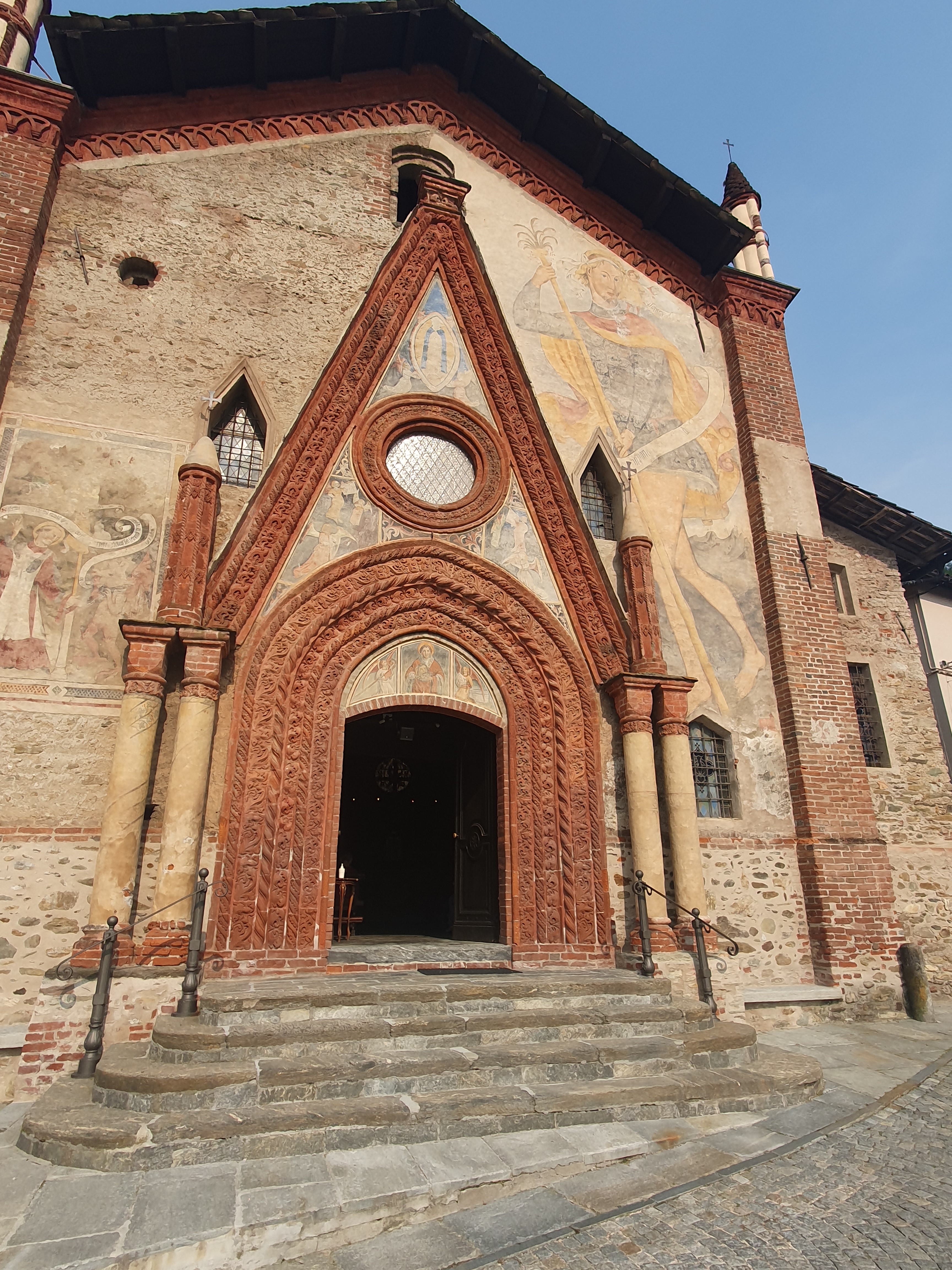
look at as we wait for our pizzas, then wander back up to the campsite to dine. Chatting late into the night with the owners, we find out a lot about the local landscape, future cycling opportunities, and what lies ahead for us tomorrow.
Shaking dew off the tents in the morning is unpleasant, but easier than shaking doubts about the challenge that lies ahead. The Col Agnel is only 57 kilometres away, but, at 2744 metres it holds the highest paved road crossing between Italy and France. Circumspect, we round the intersection beside the Varaita bridge, through which the 500m contour passes, turn left and set off up the valley.
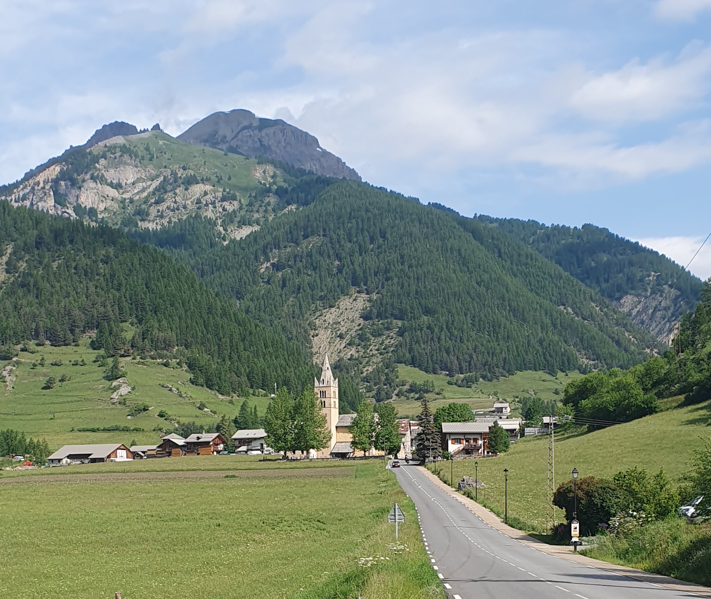
The road through to Sampeyre is so gradual that you barely notice the ascent. Views of distant church steeples, green pastures below steeply wooded hillsides, the turn of the pedals, absorb us into the routine of cycling. Only after 30 kilometres does anything seeming like a hill appear, and with it even better views of the valley sides where broadleaf trees thin out into a dominance of conifers, and stone flagging replaces roof tiles on the roadside cottages.
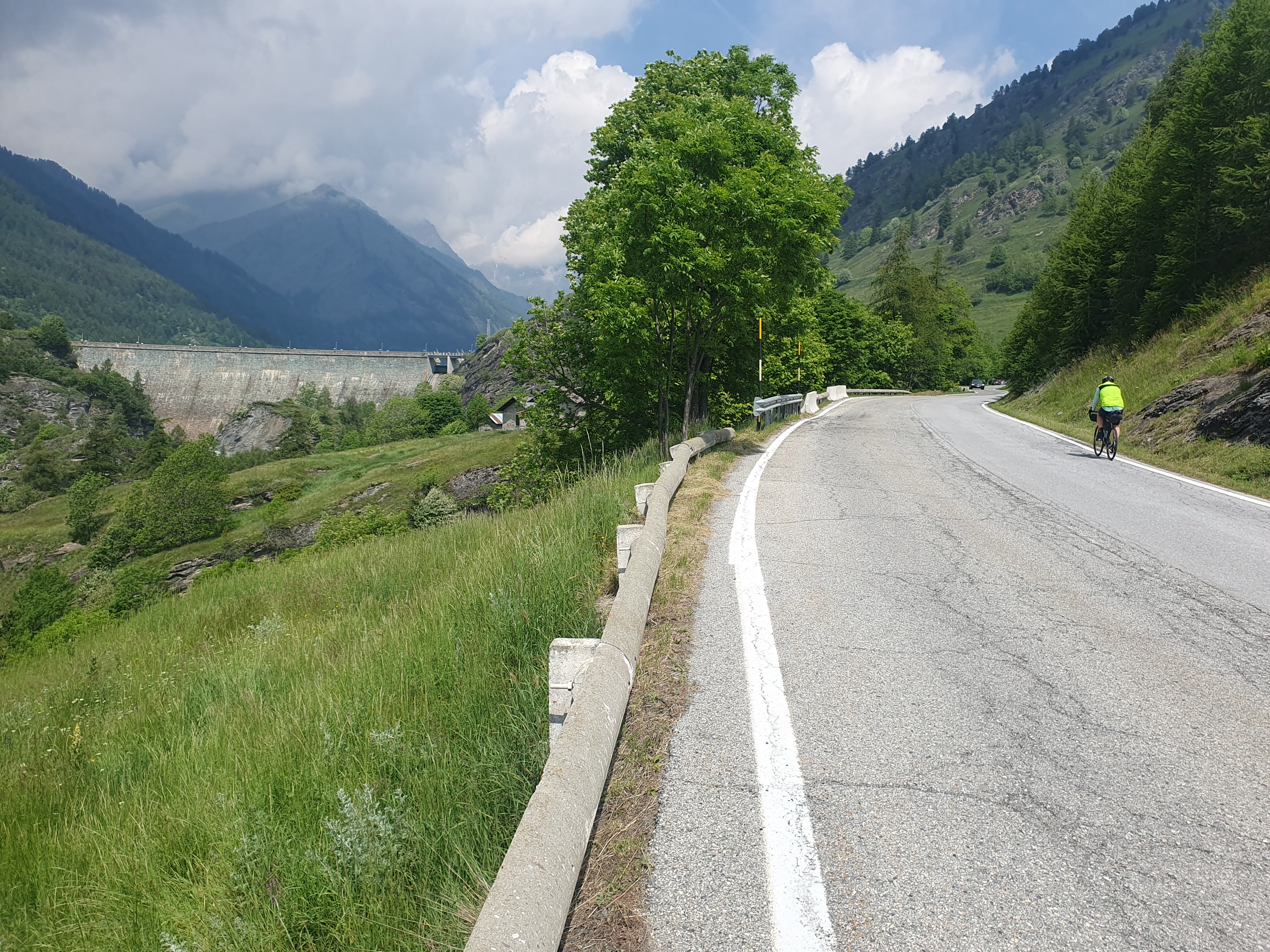
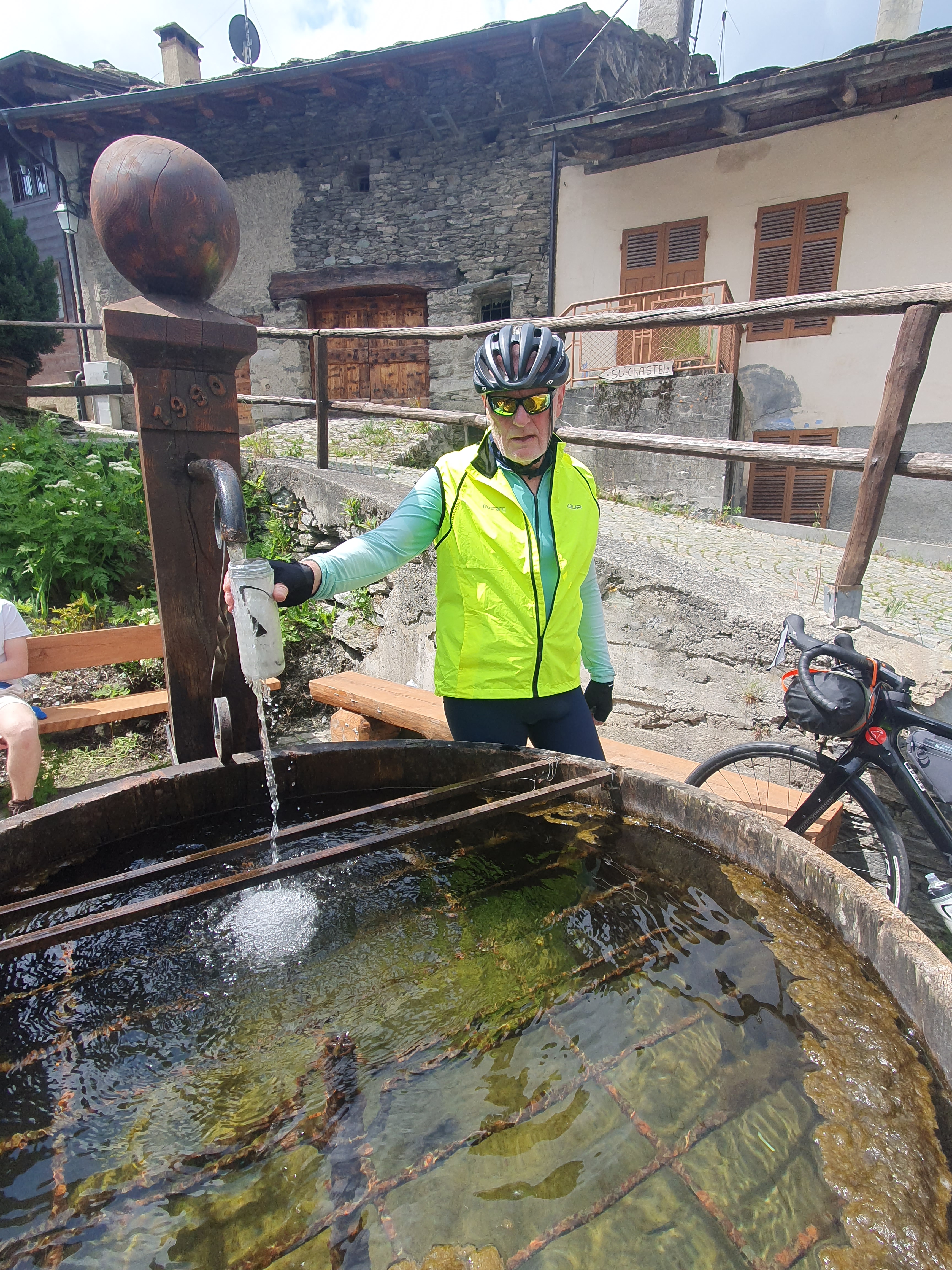
Winding up through Casteldelfino, we see the high wall of a dam against which to measure our progress to the pretty, lakeside town of Castello. Here the road levels out and sidles above the shore. On one corner there’s another beautiful old church and opposite it a spring-fed fountain from which to recharge the water bottles, the first of many such fountains to come.
The lake edge laps the 1600 metre contour and beyond this begins the actual ascent, though never particularly steep. Fir trees begin to thin into alpine pastures around the village of Chianale at 1800 metres. Only here, after 45 kilometres, does the road really start to rear up, disappearing as it climbs into a growing cloud cover. We look up into this with some concern, then down into the grey stone village below. Yeh, time for lunch.
Chianale is small and built around a boisterous alpine stream. There’s a bridge spanning the little torrent
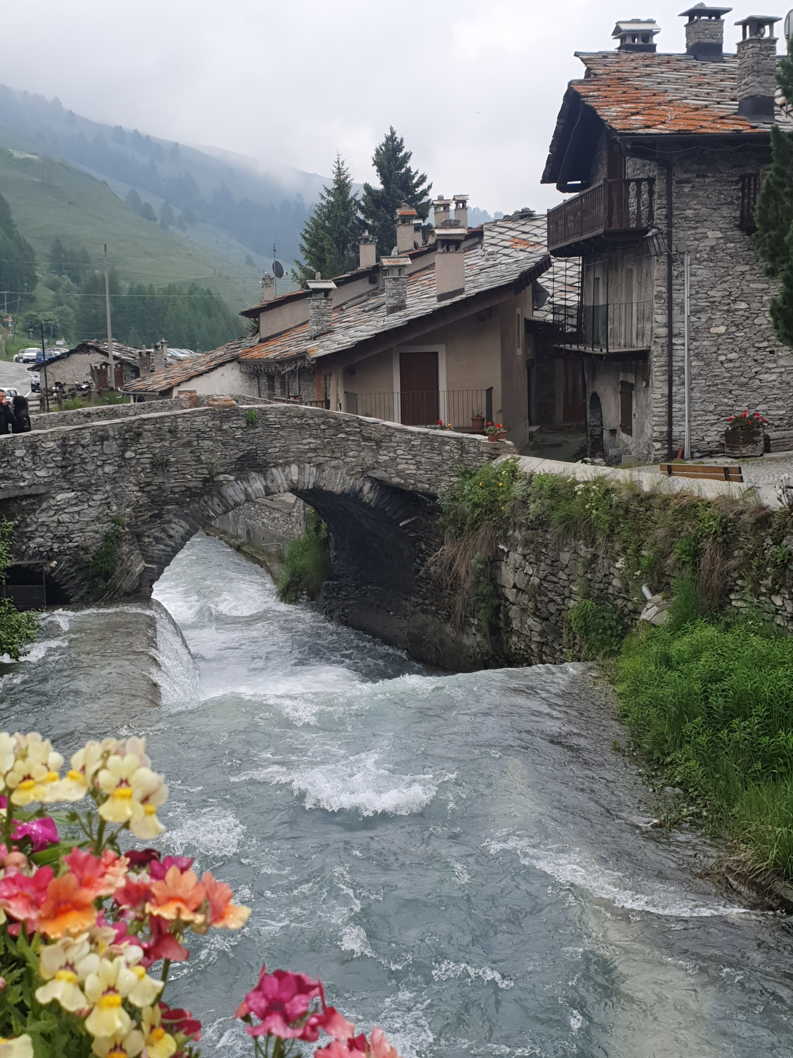
to link both halves of the hamlet. This stony arc sets a graceful precedent that the village houses uphold.

We wonder if this rural place will have anywhere to eat, then stumble across the modest Ristorante Laghi Blu. Inside there is just one lady, greeting, seating, taking orders, cooking and serving a substantial number of Sunday day trippers, plus a couple of weather-beaten old locals in the corner, speaking, who knows, maybe Occitan, a mostly extinct form of Provencal French which does linger in these valleys.
We opt for the cheaper, 15 euro lunch special and, like the brew of clouds gathering on the heights above, settle in. No point expecting too much from this hard pressed lady. Nonetheless, a couple of petite tomino cheeses, not too runny, are quick to arrive, along with some bread and berry jam. Nice, but worth 15 euros? No, wait, we’re no sooner finished than she sets down substantial and saucy plates of gnocci. This looks like a lot of ballast for the hill. Still, good fuel. Done, we are just congratulating each other on our venue and budgetary choice when she arrives again bearing dishes featuring a variety of local sausage resplendent in polenta. It would be rude not to soldier on. Whew! Resting yet eyeing the door, neither of us are game to even mention the prospect of desert which, of course, briskly arrives in the form of a perfect, sweetly sauced pudding. Really? Too good not to eat!

Once done, it’s hard to contemplate climbing out of a chair let alone up that hill. But she arrives again, wondering what coffee we’d like to finish with. What an amazing woman!
Meanwhile the hill. It hasn’t gone away. We struggle at first not to wander across lanes like overfed geese, gradually ride straight, then bend to the task as the gnocci and polenta kick in. The road

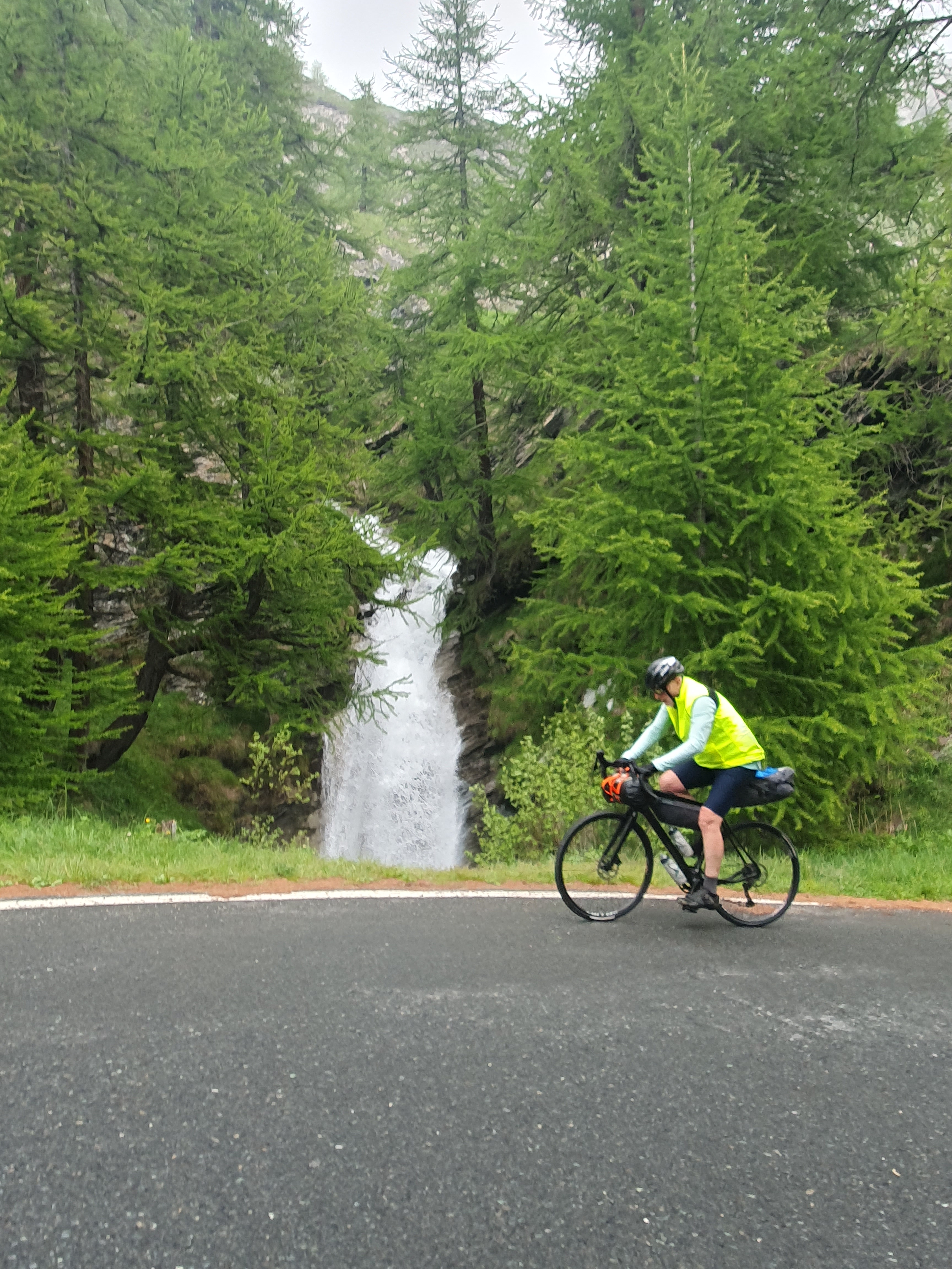
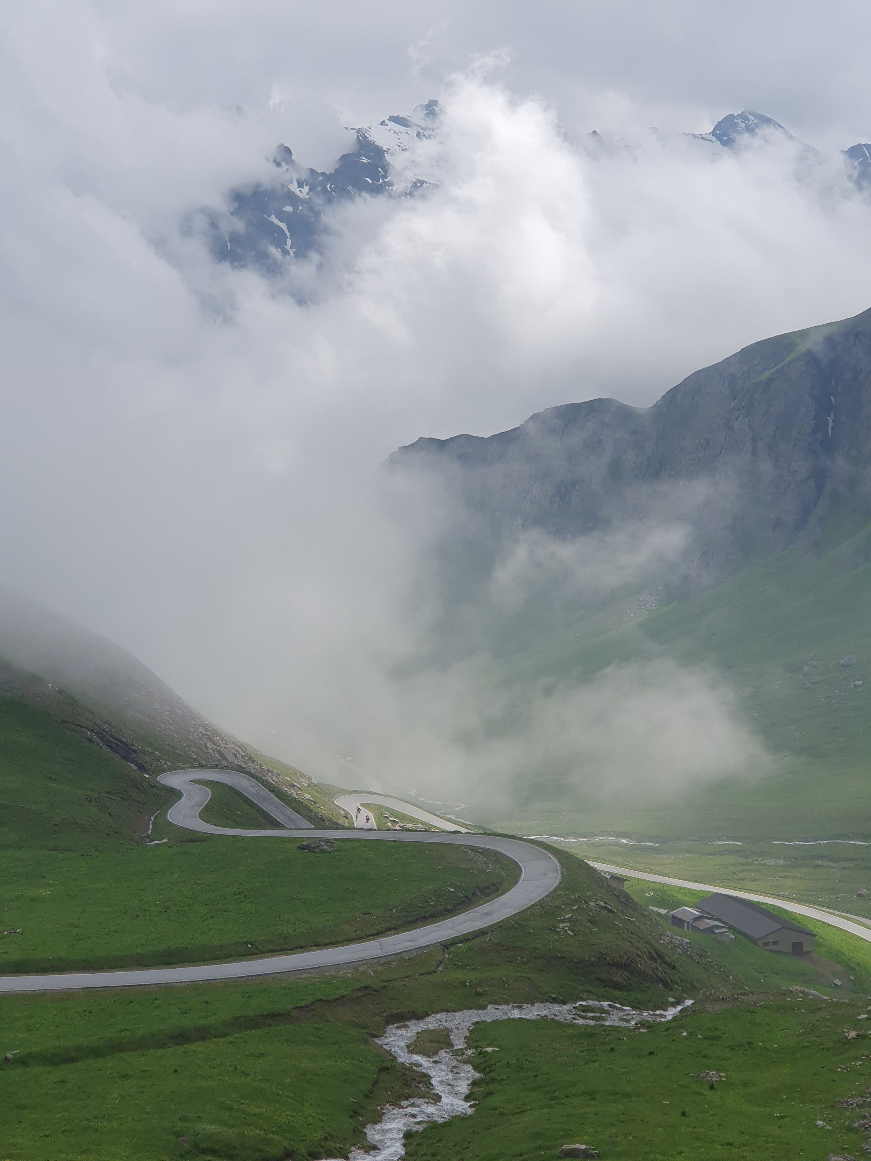
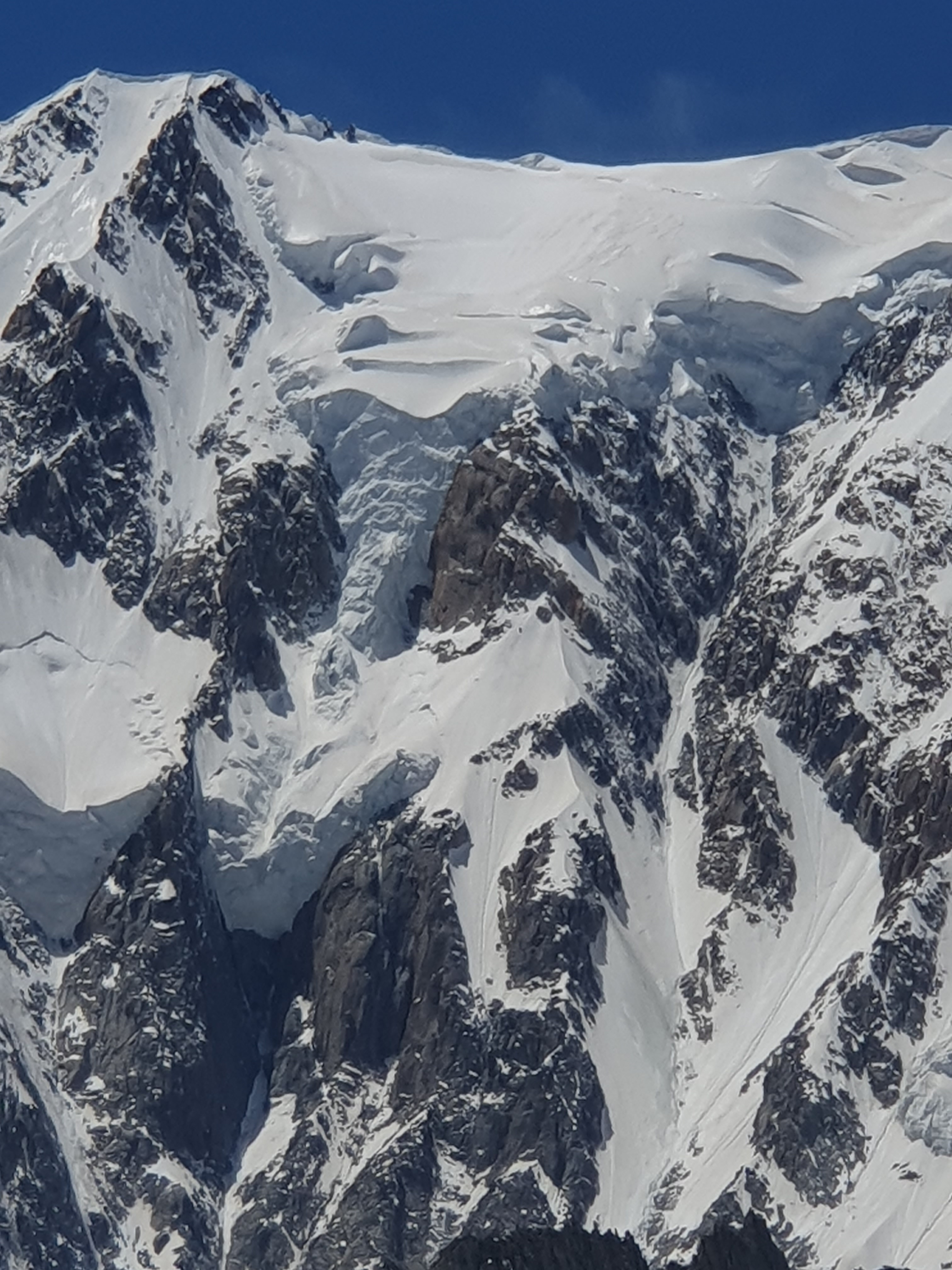
becomes steep. Actually and always steep. The fir trees shrink in size and gather like flocks through which alpine pastures wander. One last farm with flagstone walls in poor repair and the road switches back, climbing into a cloud ceiling past screes and waterfalls charged by snow melt from above.
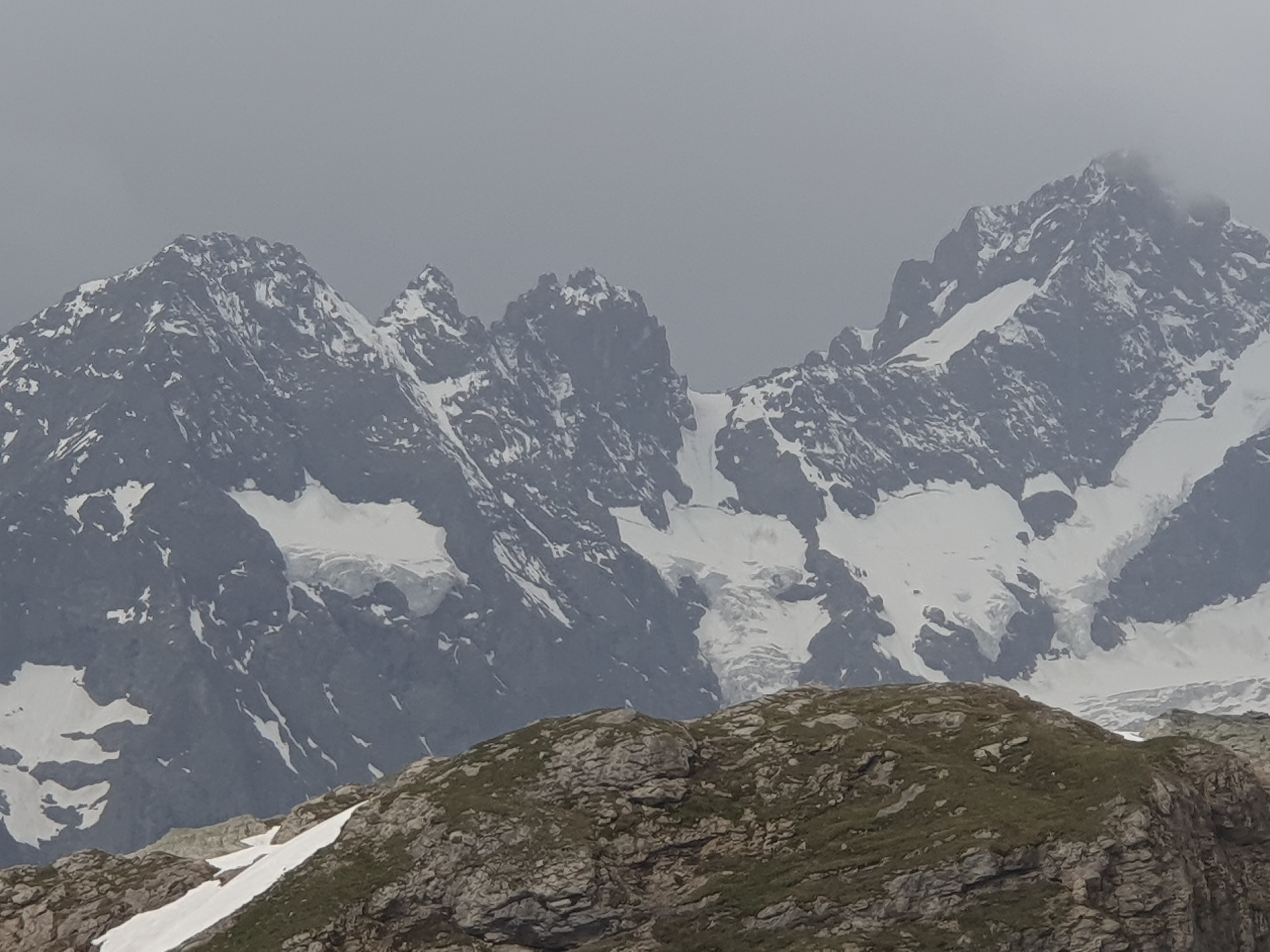
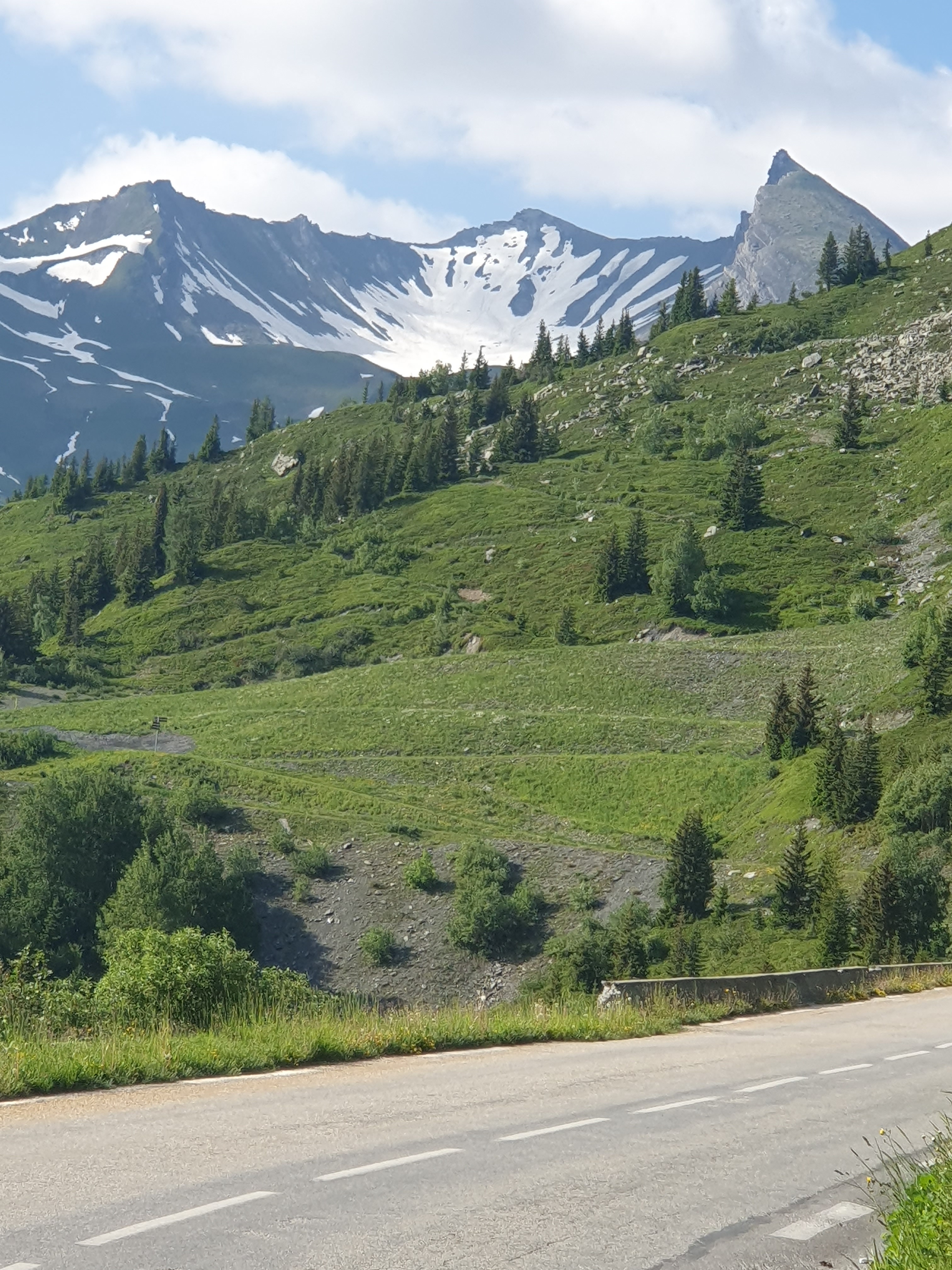
We reach the first snow bank at a big bend where the trees are all gone but where the cloud pack grows ragged and lifts. The road has become our constant, looping the mountainside in lazy coils as it climbs, suggesting as they ascend beyond sight that we too should just take it steady.

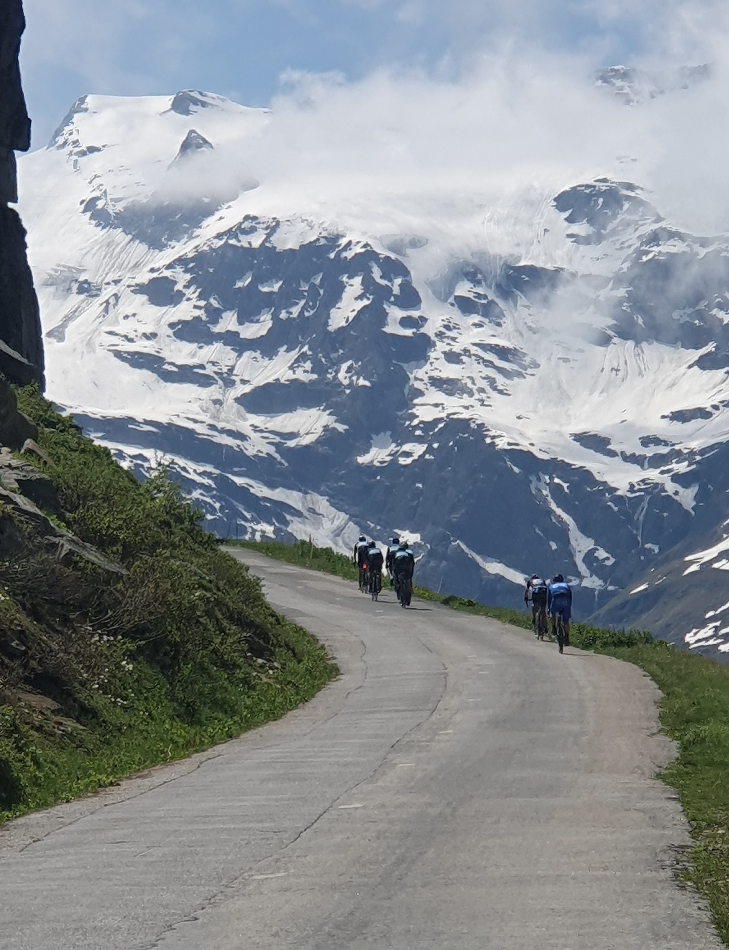
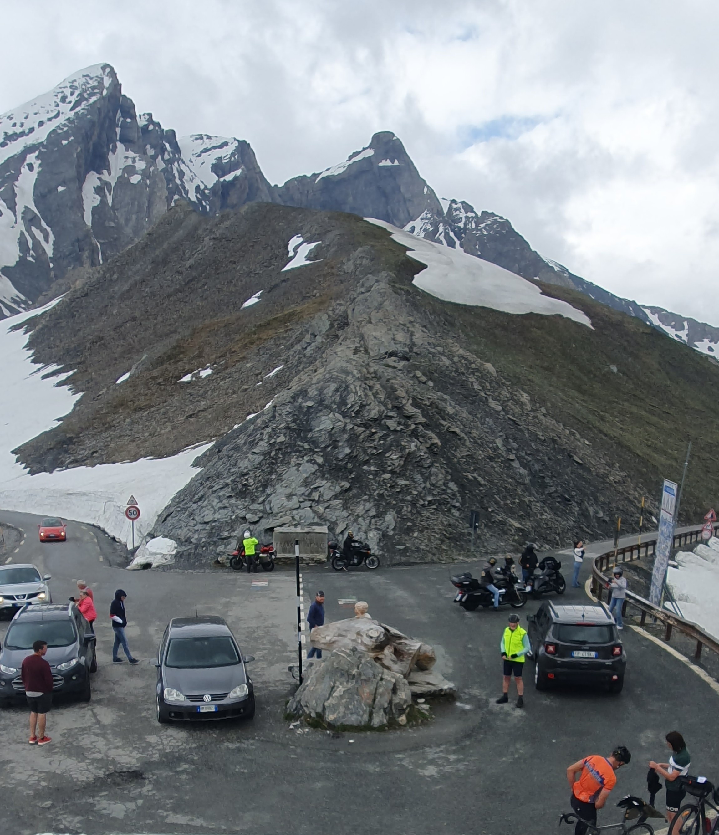
The turning of a bicycle wheel is the translation of a rhythm of breathing and effort. Ours carry us higher and higher till even the grasses and alpine flowers are ceding ground to steepening rock and snow. The road loses the ease of its lay on the land, beginning to jag as it seeks its path, but we keep on, steady. One last, sharp bend reveals the Col and riding together we reach it. Ross and I have shared many years of bicycle
misadventures, but this beautiful, long hill is not one of them. A couple of friendly young Italian riders have also arrived and we all look down to see their third friend, far below at a bend. Slowing, she gives up and starts to walk. The young man who has just pulled up jumps back on his bike and hurtles down to join her. She remounts and it’s a moment of joy we all share when they arrive.
The three of them are heading back into Italy but we remount and scoot down into France, thinking about campsites. There’s an alpine refuge a couple of hundred vertical metres below the col which would probably be a good alternative, but the plunge of the road invites us to keep going, though not too fast under the slightly damp conditions. I don’t think the French side is as attractive in its upper parts as the Italian. There’s a small kiosk selling takeaway food beside the road and being late in the day I swerve in, thinking about dinner as we’re not carrying or cooking food in order to cut down on weight. They’re about to close and have a single fruit flan left, which I buy and stash on the bike with some difficulty.
Catching up to Ross we come to the first small village, an unassuming place called Fontaine Gaillarde. Here there’s a sign beside the road suggesting ‘snacks’. Past experience has taught me that looking for a meal in small French towns on a Sunday night is synonymous with going hungry, so I assume that they just don’t take their sign in, but we walk down some steps and are met by the slightly concerned looking patron of an actual restaurant. I think he’s concerned because he and his wife are only getting ready to open. Nonetheless, we are welcomed in, served a beer or two and some bread and cheese. Despite a substantial language barrier, they’re interested in where we’ve come from, informing us that we’re the first Australians they’ve had as customers. The place offers sweeping views down the L’aige Agnelle valley and they point out a campground just a couple of kilometres distant so, reluctantly, we leave.
Although, rolling into the pretty campground of Camping de Chanteraine, we find more of the same in terms of welcoming and friendly demeanours.
We pick a spot to pitch the tents beneath a tall stand of pines and it is as perfect and quiet as we are tired.
Pack up in the morning at a leisurely pace. Beyond the pines that shelter our tents the grass is heavy with dew.
Mists spread thin around the heights then fade to blue. We don’t have a big day between us and Briancon, except for one thing, the Col de l’Izoard. At 2360m it’s almost 400 metres lower than the Agnelle, but still quite a hill. Currently at 1900 metres, we have to descend the Agnelle valley to the Guil river, follow it downstream a short distance then turn right at an intersection to head up through Arvieux to the Izoard. This last junction is at roughly 1350 m so we have a nice downhill run in front of us followed by a modest thousand metre climb so, compared to yesterday, easy. Doing the Agnel as well as the Izoard in a day would probably be feasible for someone already fit, especially if starting from higher up the Varaita valley than we did. However, our plan is to enjoy these cols and leave any records plus our aging joints intact.
It proves indeed to be a nice downhill run. The Aige Agnelle is soon joined by a big valley coming in on the left, the Aige Blanche. Ross, although well versed in the cycling history of the Alps, hasn’t actually cycled these mountains before. The immediacy of being here on this perfect day, surrounded by such an unspoiled alpine landscape, and with more fast cornering, and downhill hurtle than you poke a stick at, has him rapt. Me too for that matter.
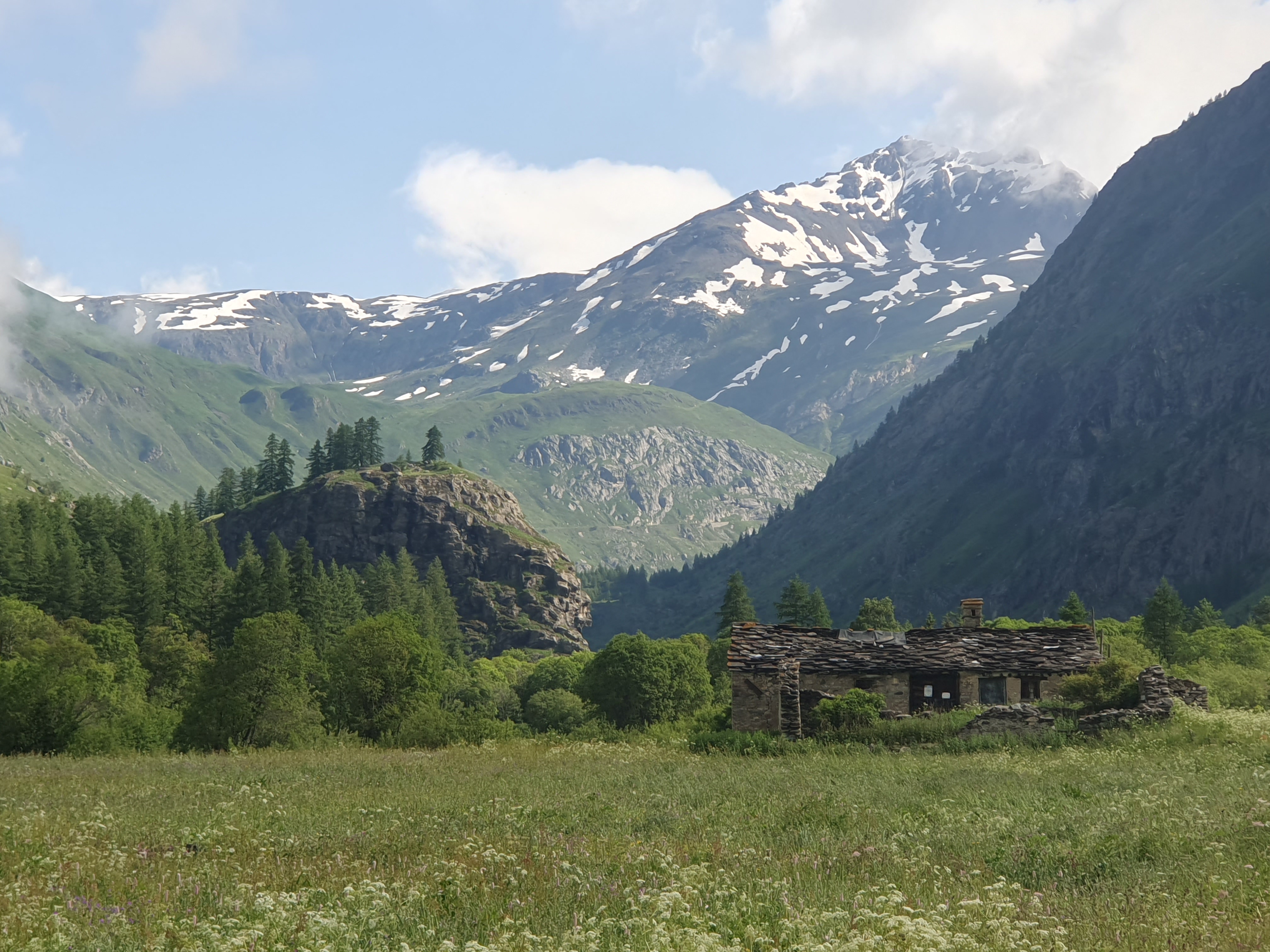
It’s so enjoyably easy heading downhill that we don’t stop for a coffee or even breakfast in the hamlet or two that we pass through. A tall and bizarre capstone pinnacle appears across the valley but is soon left behind, we reach a town, the Ville Vieille where the Agnelle meets the Guil, but keep on going, leaving the Old Town behind until the even older Chateau Queyras comes into view, squatting medievally on a knoll which we roll past on the right.
Soon we reach the turnoff onto the D902, which climbs up to Arvieux.
We start to encounter cyclists, mostly out for the day, a lot more than yesterday. One can usually hear them behind, changing down in order to accelerate past our encumbered machines.
In cycling there is a complete paradigm shift between downhill cruising and uphill grind. It’s a bewildering shift which sows a burden of doubt into the uphill part. So I am just beginning to reconsider the notion of a modest thousand metre climb when we reach Arvieux which, small and pretty, hosts an inviting fountain from which to refill, and even better and right next door, A Salon de The. When in France, and being an optimist, I never ride past something that calls itself a tea room. So, well past breakfast time, we stop to bolster ourselves for the coming ‘modest’ hill.
The tea room is great insofar as having a good range of cakes and pastries as well as a choice of tea or coffee. However, there’s one thing which leaves me distinctly cool, much like the small quantity of warmish water that invariably gets served up, partially filling a tea pot with an unopened tea bag sitting beside it, all of which you’ve seen sitting on the counter for some minutes before it arrives. Really, I just don’t get it.
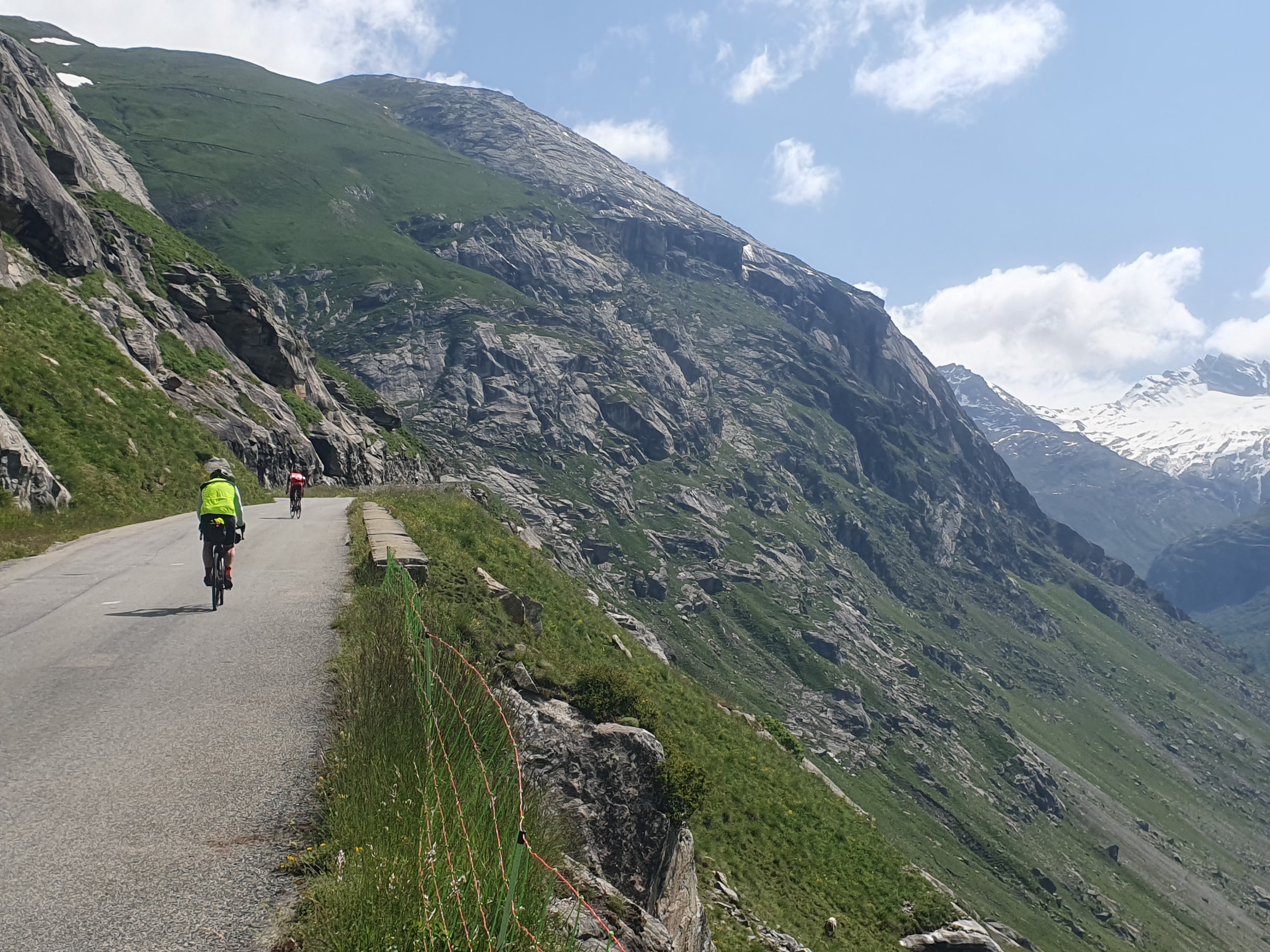
Anyway, the Izoard isn’t getting any closer or lower. The actual climbing starts straight out of town (1800 metres elevation), toys with us in a will-I-or-wont-I-steepen kind of way for a few kilometres, then blasts up out of the valley pastures after swerving into a string of switchbacks. In line with my recent beverage I’m cool with this and keep peddling at a steady pace, although Ross has worked out a strategy involving rests at the corners. Nonetheless, for the sake of our spirit d’corps I do wait for him after a few hairpins, then once again at a lookout above the main forest. Many cyclists glide past, including a couple of fit looking and lightly loaded Australians doing a tour, and a young man toiling bravely under a massive load of panniers and other bags.

Although we never see the Australians again, we do catch up with the young man, doing it tough in the famous Izoard desert, a spectacular wasteland of scree and pinnacles which occupy the heights from tree line to summit.
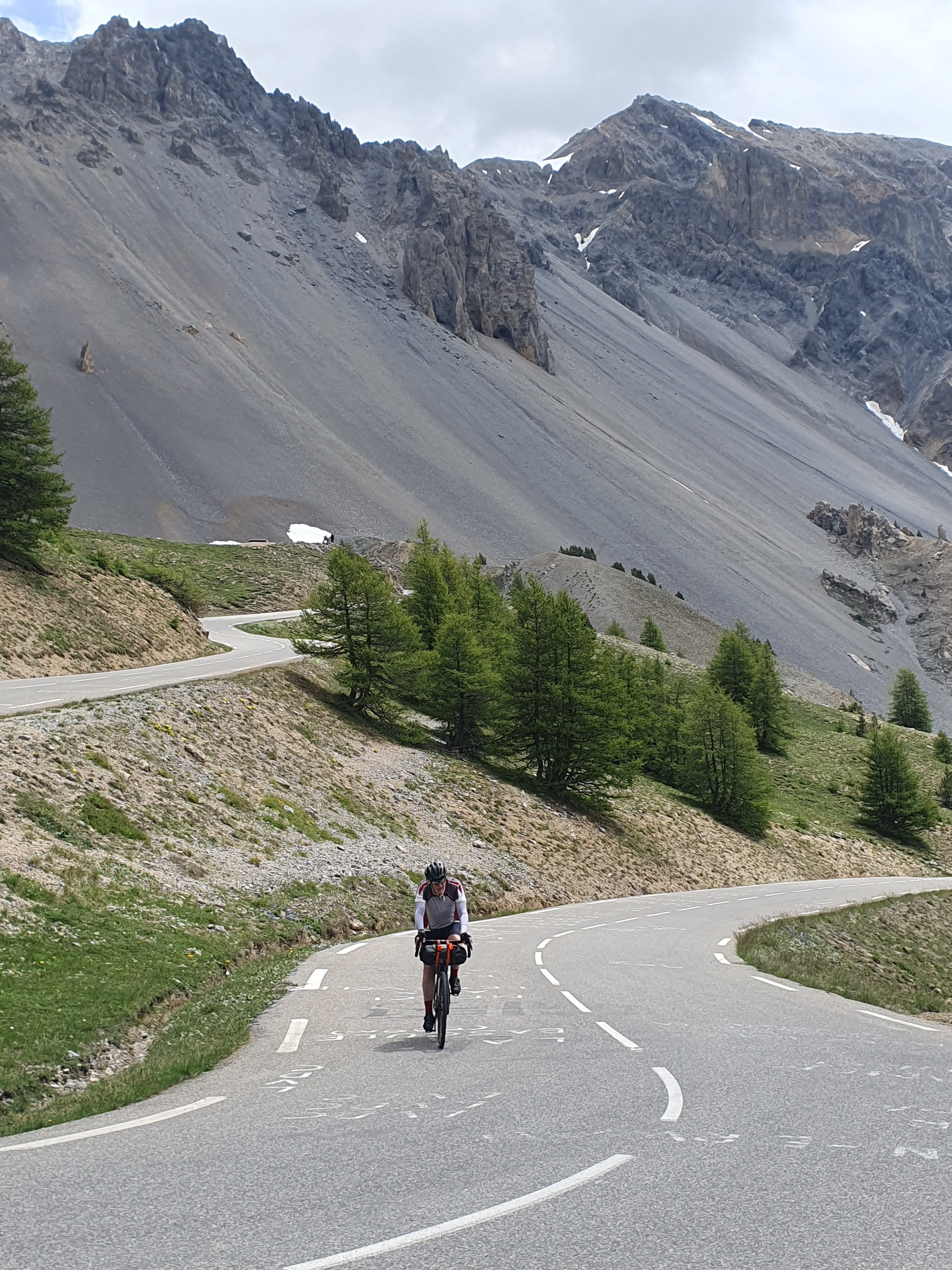
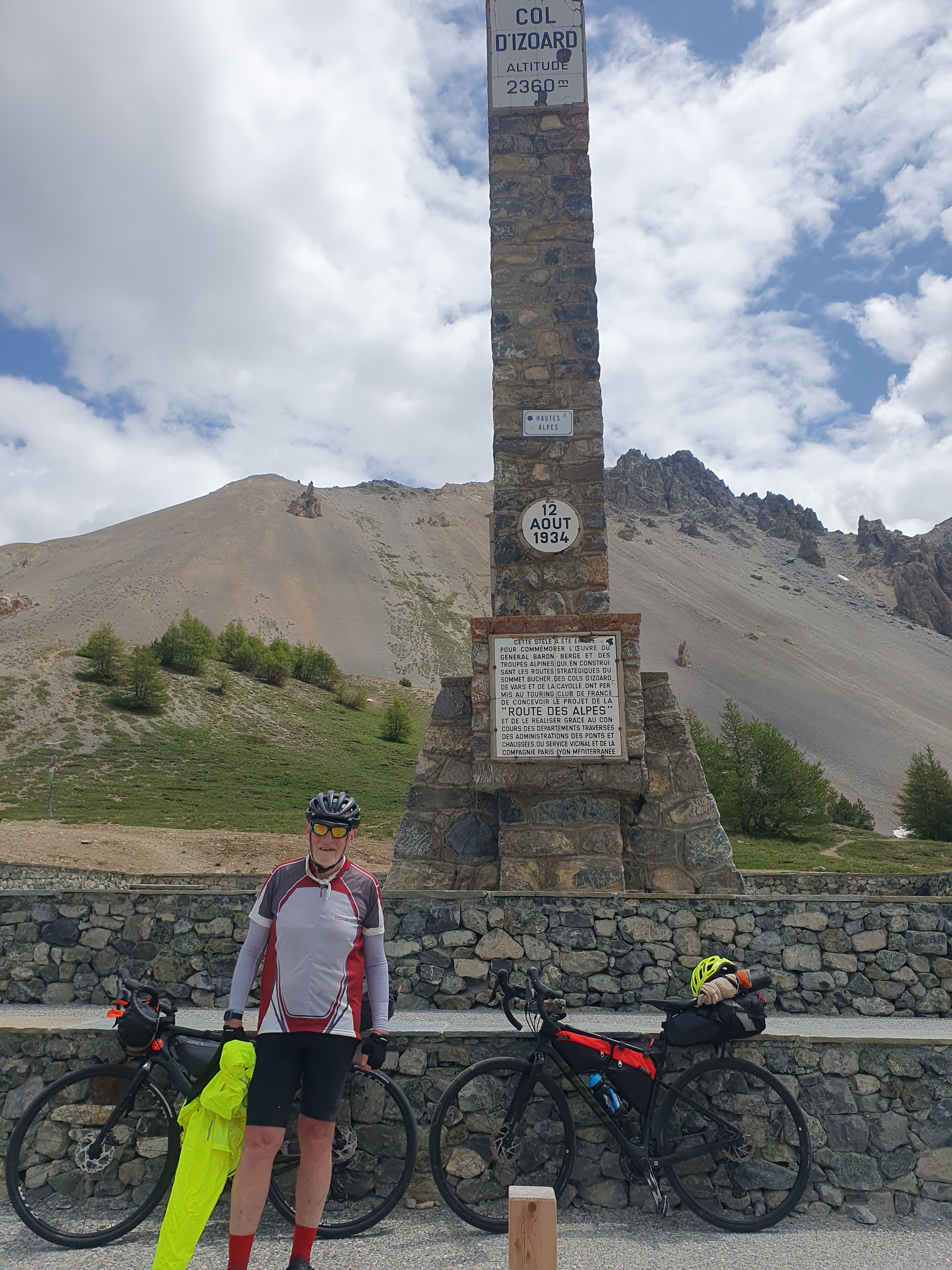
The road levels for a while as it crosses the broken desert, climbs steeply again then eases once more. The top seems very close and I shout out some encouragement to the young guy, labouring mightily on a lower bend. But of course another set of steep switchbacks appear, but so tightly coiled that the summit just must be nearby.
And so it is.
Chuffed, we chat to the young guy when he rolls up, plus a lady from Lyon who has ridden up from her summer house near Briancon. He turns out to be German, has ridden from Nice and plans to stay each night in a mountain refuge, including one just down the hill from here. We can’t help wondering why if he’s not camping he has so much gear, but it seems rude to ask.
On this perfect day the road is dry and we have nothing but downhill pleasure separating us from Briancon, 20 kilometres distant. So we let it rip, quickly passing the friendly lady from Lyon, tearing through a string of tight corners and passing the Refuge Napoleon and, in short order, the tree line. Here, the angle eases a little but the straights are longer so we can crank up yet more speed.
Instead of traversing mountain slopes, the north side of the col descends into a broad valley. The mixture of pasture and forest seems singularly beautiful, opening out here and there with more views of broken desert terrain or, further down, intriguing glimpses of distant hamlets.

We stop at a bar in Cervieres for lunch before rolling easily down the remaining kilometres to Briancon where we have a bed and breakfast booked in town.
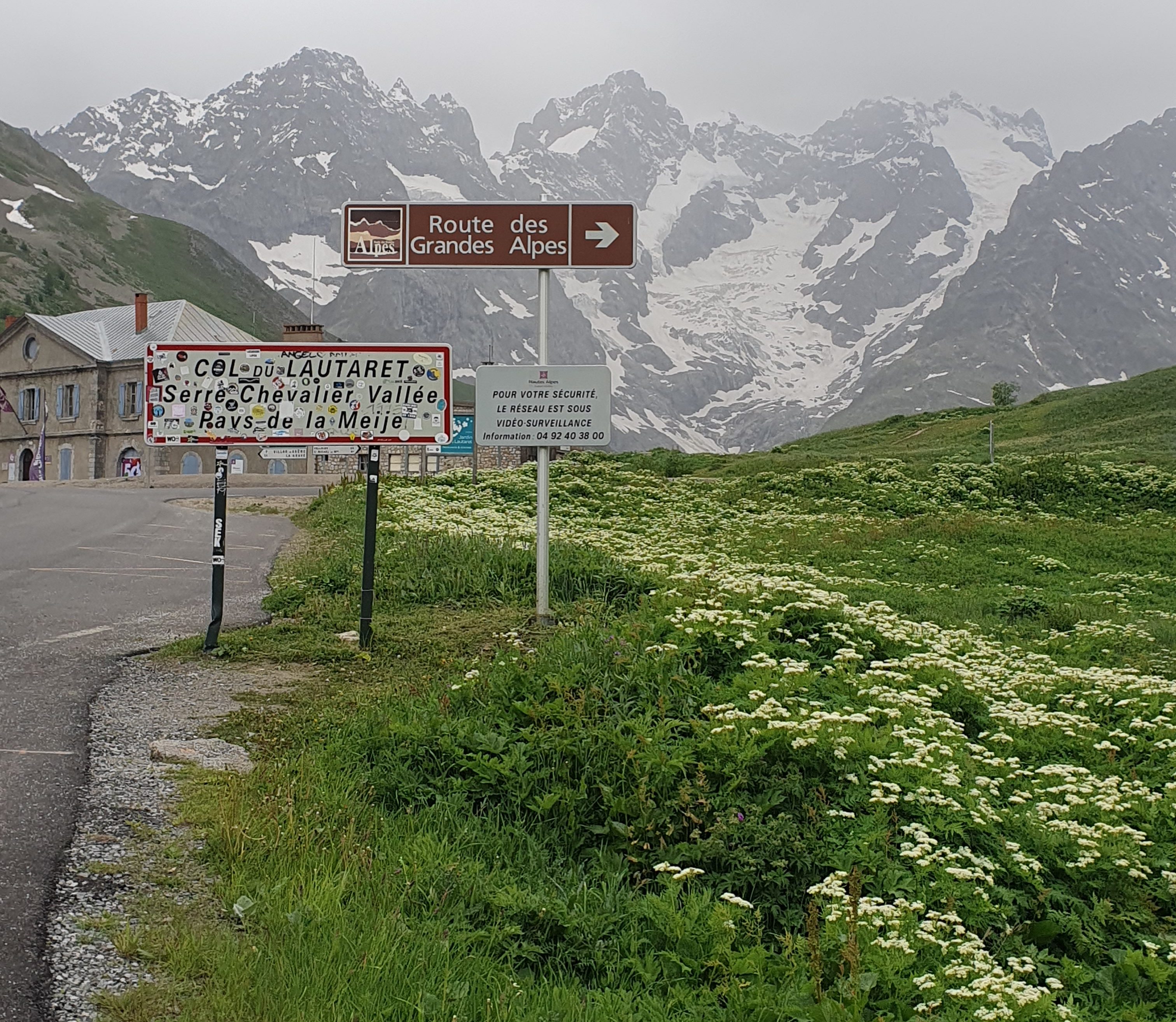
Actually, it’s classified as a city, at 1326 metres the highest one in France, its long history dating back to Roman times, by whom it was called Brigantium. Here the main Roman road into Gaul branched, one following the Durance River southwards towards modern day Gap, the other climbing northwest up a gentle valley to cross the Col du Lautaret before descending the Romanche River to Grenoble and so on to the Rhone Valley. These days Briancon is probably best known through its frequent appearance in the Tour de France.

Neither of us has been here before, pleased as we are to rectify the matter. However we do find ourselves exasperated to discover that our accommodation waits, perched high above us in the old citadel, the streets climbing to it so steeply that we have to dismount and do the walk of shame. It’s hot. Tomorrow we are having a rest day.
Our rest day in Briancon is just that, restful. We see the odd historic sight and the inside of the odd café and restaurant. I’m searching for some bike parts I haven’t been able to find in Australia, but the first bike shop’s too small and the second one is locking its door for the afternoon break between noon and 16:30. And arriving on the doorstep as the key turns cuts no ice.
When the next morning arrives, the weather is closing in. We set off for the Col du Lautaret with some misgivings, with rain forecast as well as strong winds about the heights, which is exactly where we’re heading: the Lautaret is at 2056 metres, and that is just a warm up for the second col we plan to plan to reach from there, the famous Col du Galibier which, at 2642 metres, is pretty damned high indeed.
Still, the weather is amenable enough as we cycle up the broad Guisane valley, its gradient seeming so gradual as to be barely uphill. We ride at our own pace, each lost in uncertain thoughts of the buffeting winds and driving rain or snow that are presumably waiting for us.
Over 28 km our road steepens so gradually that the Lautaret has hove into sight by the time we realise that, yes this road is definitely uphill.
Pulling up at the turn off it’s also definitely time for the raincoat. There’s a bar or cafe across the road so I wander in to wait for Ross and order a couple of coffees. He arrives after a few minutes and warms his hands around the cup. It seems surprising that we have already ascended 700 metres, but nice to dwell on that thought compared to worry about what is to come.
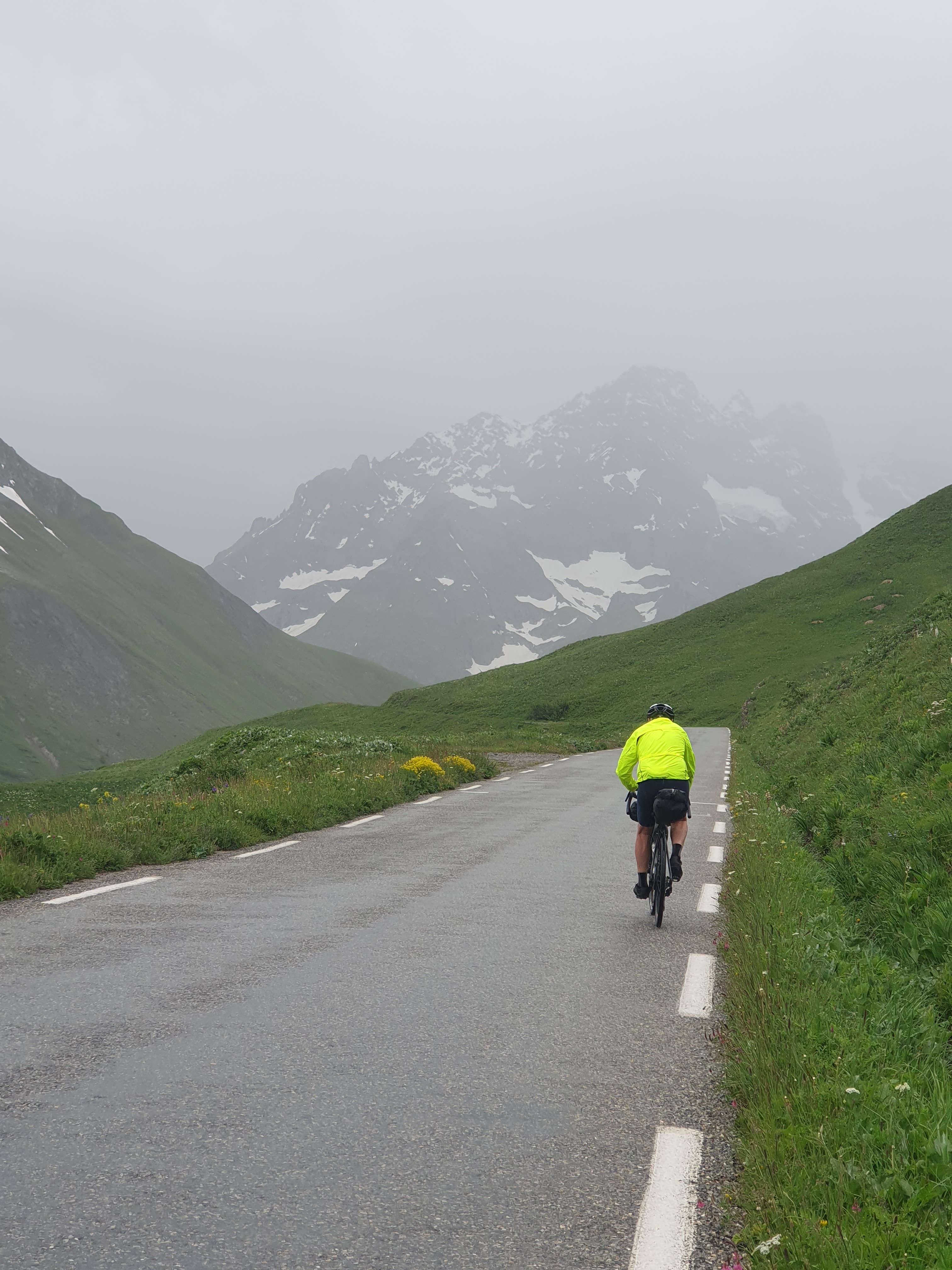
It’s raining properly by the time we step outside. The Route du Galibier throws us a few lazy loops that warm us up as we climb. Then, after a tight hairpin the road climbs steadily across a steep mountain slope towards parts unknown. Well, this is what we came for, so we just keep at it.
And the wind has not blown up. The road rounds a ridge and climbs up into a narrow valley. Still no wind and the rain is easing. Rounding the head of this valley, the Torrent de Roche Noire, we reach the first snow drifts and there are hints of sunlight as the road wends on upwards across the far slope.
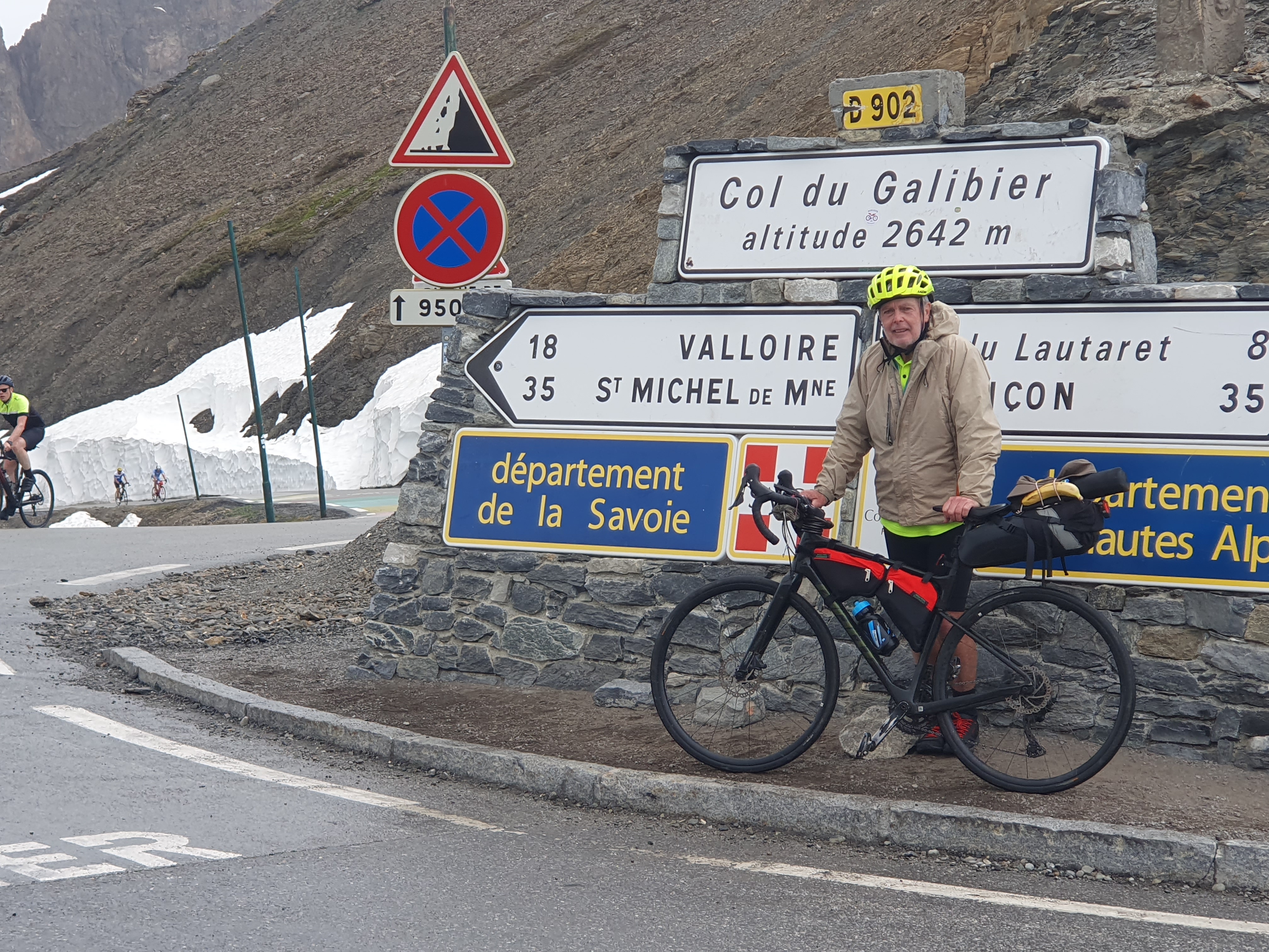
Rounding another prominence we look up to see the road coil into a set of switchbacks then, to our surprise, reach the Galibier tunnel where the departmental road, the D902, avoids climbing to the actual top of the col. Bending to the effort we reach the tunnel and turn right onto the D902B. Not far to go. Some more tight bends and we’re there, at the famous Col du Galibier.
I don’t know about Ross, but I feel surprised to be here after such a modicum of effort. Definitely though, like me, I can see how pleased he is. Especially as we consider what the day holds in store for us: not rain, not gusting wind, but a lot of downhill instead. Cycling heaven.
Nonetheless, with the wet road coiling and recoiling below, we set off cautiously, yet quickly pass the northern entrance of the tunnel and with the road already drying, take the following hairpins at speed before accelerating onto the straightening road below. The north side of the mountain is more rugged and desolate than what we have just ascended, but with not a tree in sight, spare in its beauty.
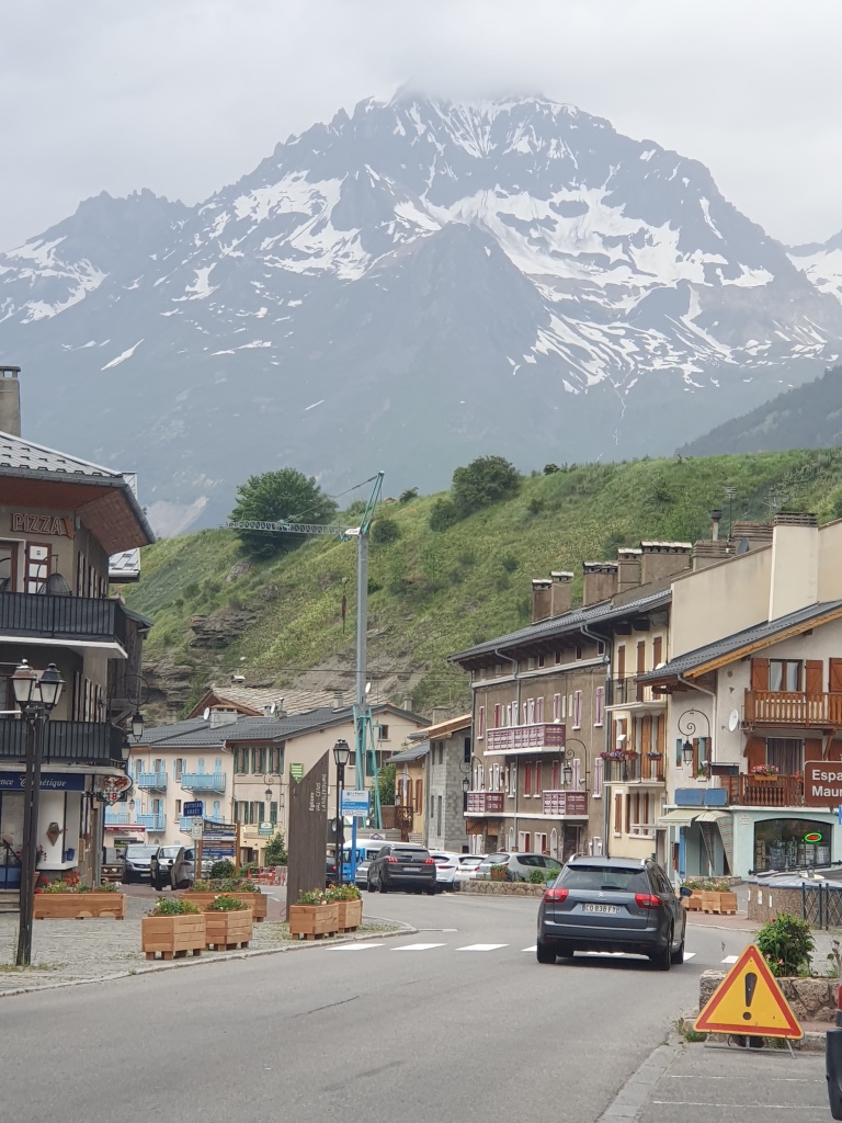
After a few kilometres of this speeding we come to a small and slightly ramshackle auberge beside the road and stop for an okay lunch. After this the angle of the road eases to a consistent and steady downhill where the impetus to pedal is simply to go very fast instead of just swiftly. At 1800 or 1700 metres pines begin to appear beside the road. And onwards we press to reach a town with the lyric title of Valloire, which is a nice enough looking place despite being a ski town.
The road levels out then climbs slightly. At some point down here I know there’s a feature called the Col du Telegraphe. Because of the name, I have some vague notion that it’s going to throw a challenge our way. Yet after four or five kilometres we have climbed a very gradual ascent of a few tens of metres. Not a hill with much punch in it, however Telegraphed.
At a sharp turn on the point of a ridge, the road resumes its downhill plunge. It’s not like either of us are inclined to complain, but this descent from the Galibier just goes on and on, jagging sharp hairpins, pausing here and there with a show of moderate slope, only to drop the hell from sight like some kind of roller coaster.

Eventually we reach the floor of the Val d’Arc, which sits just shy of 700 metres. This, if you add the small uphill bonus the Telegraphe has delivered, is over 2000metres of descent. And so I come to understand the notoriety of the Col du Galibier. All we’ve climbed is the easy side.
It’s a narrow valley floor we find ourselves in, but with a lot happening in a transient kind of way, with major and minor departmental roads, a superhighway and a train line all competing for space. We turn right and head upstream, joining in slower motion the throngs of passing motorists, whose uniform purpose seems to be, to be somewhere else. Our ambition is more modest, being centred on a campground with good reviews just six or seven kilometres away at Orelle. I think there’s supposed to be a supermarket on the way, though we don’t find it. The superhighway also hides itself in a tunnel as the valley narrows further. I wish we could too, as trucks and cars hurtle past. It’s a slow uphill and the day has turned hot with the only shade being cast by the odd concrete structure upon which slow trains thunder.
We identify Orelle by its prominent telecabin, or cableway station. So a ski resort of sorts. Or perhaps more accurately, the ground floor lobby of resorts that exist somewhere out of sight, far up the containing mountain slopes.
We track down the campground and, yes, it is pretty good, comparatively quiet in its forest surroundings, grassy and with good facilities. We pitch the tents not far from a pleasant pair of German cyclists. By the time we’ve cleaned up it’s time to start thinking about dinner so we ride back into town, or at least to the telecabin station, to check out the restaurant there. Which is closed. For the season.
Contemplating this, we run through an inventory of what, between us, we can muster for dinner. Which turns out to be the one banana I’ve been carrying all day because I don’t like bruised bananas. Although we do stumble upon a cherry tree overhanging a path near the telecabin station. So, hey, we’re rich!
That evening a troupe of rollicking French fellows drive in and set up camp on the terrace just above, breaking out both the boom box and the barbie in order to assail us with noise and tantalise us with aromas of frying steaks. They get very drunk, and one of them seems particularly keen on karaoke. Eventually even his friends seem to tire of this and, like the daylight long since, the music fades. But Mr K just keeps going, sans accompaniment, slurring it out like some coked-up Johnny Hallyday. Ross decides to tough it out but I pick up my tent and move off to a distant corner of the grounds and, at last, fall asleep.
It’s not quite daylight when I awaken, 04:30, 05:00. The birds have stirred, abandoned their aubade and fled from the unidentified but horrific din which is vibrating my tent. I stick my head out: the local municipal authority has unleashed a highly visible team of two-stroke-whippersnipper operators. Four of them, with a rumbling logistical column of truck and tractor. Encroyable, even the half-light is ablur with reflective strips. And no blade of grass is being spared. I pause only for a moment of reflection on how Mr K must be feeling, then shout out to Ross, ‘Crikey, we’d better get out of here!’ But he’s well ahead of me and before you can say ‘where’s my breakfast’ we are getting the hell out of Orelle.
At least there is an easy day ahead of us. Just 45 kilometres up valley to Bessans. I’m wishing, trying to see the good side of Val d’Arc apart from its impressive array of transport infrastructure, but Freney, Fourneaux, Modane, all pass without even enough enticement to stop for breakfast, the want of which has us rumbling like passing trains.
At last the valley starts to open up at Modane. The superhighway, having peeped out of its tunnel, thinks the better of it and dives back into the bowels of the mountains, south for Italy. The railway follows suit shortly thereafter, in its own tunnel. But the road we are following, the D1006, climbs up off the valley floor onto some forested terraces. And just like that we find ourselves back in the bosom of beautiful alpine scenery.
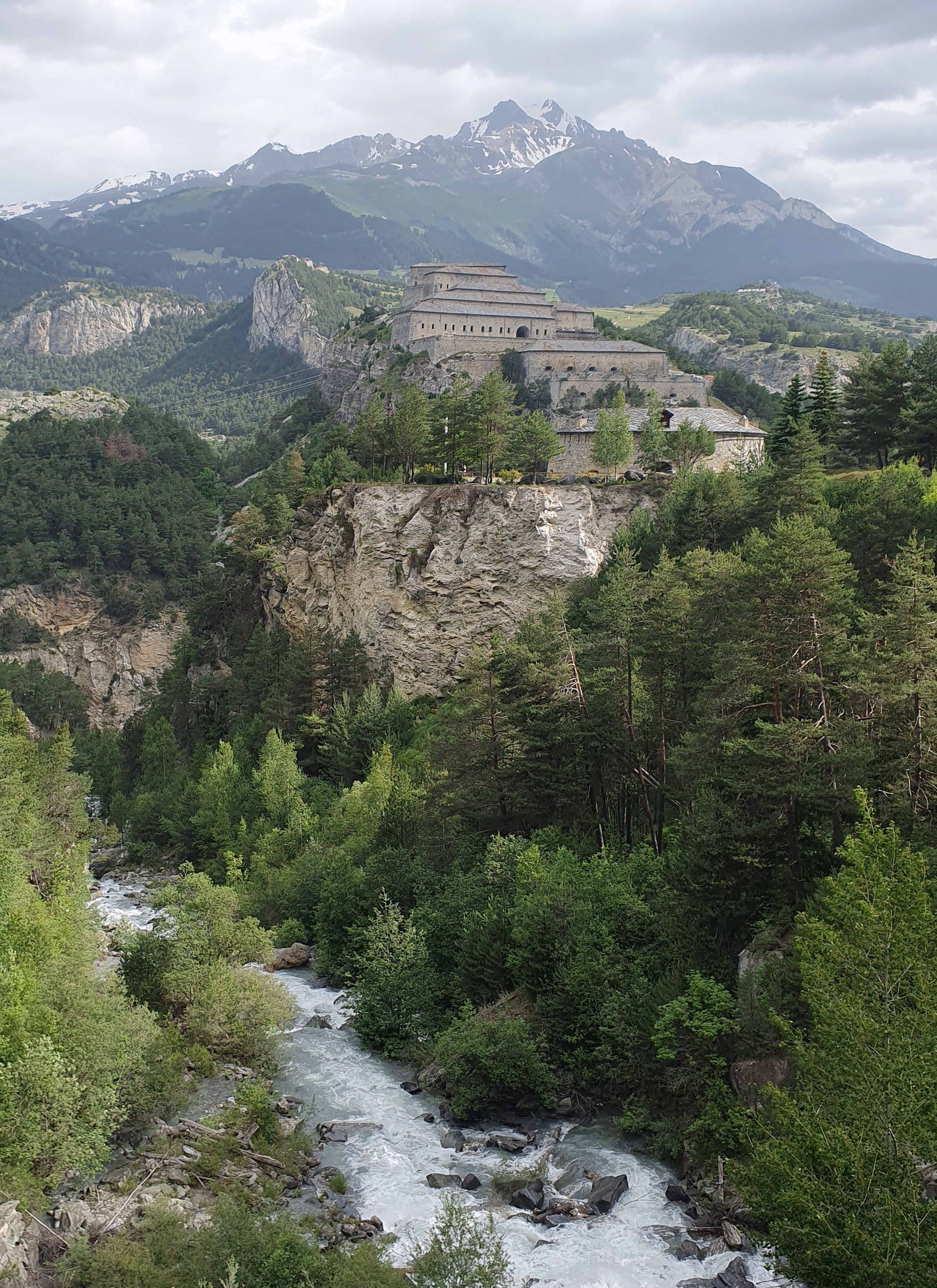

We pass a spectacular bridge with views across a line of crag-top castles that traverse and dominate the broad valley floor. Built by the Italian Savoyards after the defeat of Napoleon, they are a strategic alignment designed to discourage further French encroachment. I suppose one measure of their success might be the fact that they are now located on French soil.
A few more kilometres and the road descends back to the valley floor. We stop for a bite in a pretty village, then continue on towards Val Cenis through towns that feel once more like part of the mountain landscape.
From Val Cenis the road climbs steeply for a while, levels out at around 1400 metres before climbing again past L’Adroit to some higher terraces above 1700 metres.
Crossing an again level but broad valley floor we arrive at Bessans, or at least Camping de l’Illaz, where we plan to spend the night. It’s cold up here, a wind has blown up and it’s threatening rain as we pull in at the campground office, which we find inconveniently closed in the middle of the day and not reopening until that magical hour of 16:30.
Bugger it, what with the weather, we decide to ride into town, find somewhere where we can get a bite of lunch and check if there are any bed and breakfasts available.
This turns out to be a good move. Over lunch in the Restaurant Teyole we find a place to stay that looks good and doesn’t break the bank. Of course, having booked we find it won’t be available until, you guessed it, 16:30. So we have a slow lunch then head up the road to find the town supermarket which, it turns out doesn’t open until 15:30, which is an improvement of sorts, I suppose. Plus the building has a fortuitous portico, because as we wait a huge thunderstorm rolls in with high wind and driving rains that slant in and lash us with spray. Eventually, provisioned and with the magic hour ticking over, we ride back out into the rain to track down our bed and breakfast. And what we find is absolutely perfect, comfy, clean, nicely decorated and with lots of extras thrown in.
It turns out that this rest day up the valley has still totalled a thousand metres of ascent. A comfortable night unfolds, out of the bad weather, with food and wine but no drunk singers, and no whippersnippers.
In the morning our bike wheels roll clean on the rainwashed streets while the mountain peaks are kissing the last clouds goodbye.
The upper Arc sits deep in its mountains but is pleasantly broad and flat. We tool along easily to the pretty, rustic town of Bonneval, which is where all the easy stuff ends as the road well and truly hits the wall.
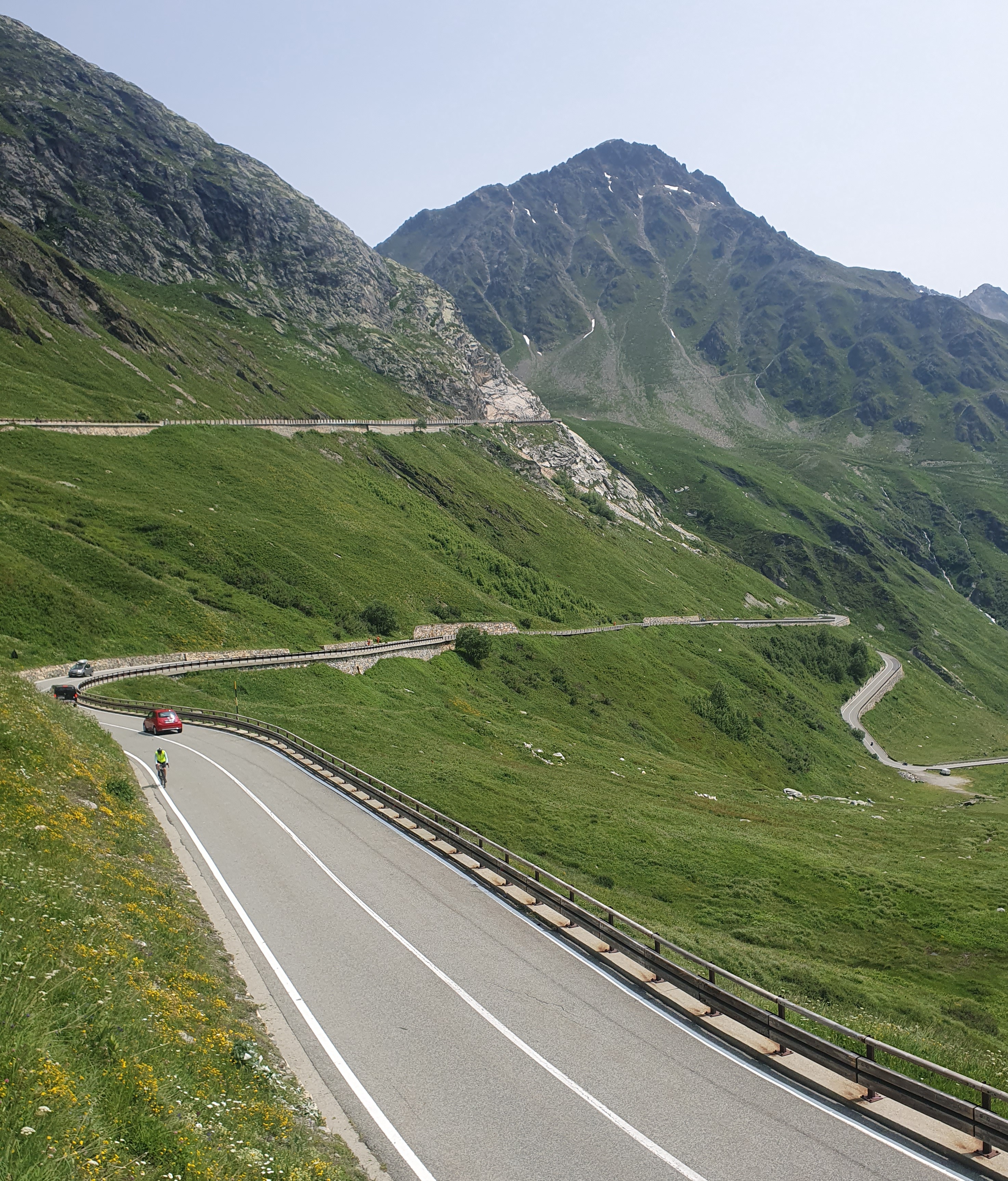
Passing a gaggle of disgruntled motorcyclists, we round a Road Closed sign and start heading up the highest col with a tarred road in the Alps, the Col de l’Iseran. At 2,770 metres it is just under a thousand metres higher than Bonneval and 13.4 kilometres distant. So really, no big deal. Though according to the local tourist office the road is supposed to be open, so we’ll just have to head up and see what happens. Turns out we are not the only cyclists thinking the same thing.
The road cuts straight to the chase, blasting up out of town. Hits a switchback and jags right, then climbs steadily across the mountainside, way above the village.
After a kilometre across these slopes, it swings left around a rocky prominence and enters the Lenta Valley. A few hundred metres more and the angle eases at a bridge across the Lenta. This valley is a treeless bowl, home to a brawling stream which comes gushing and cascading out of the base of a higher canyon. All around are mountains.
Across the bridge the road quickly resumes its climb, ramping steeply at times through three switchbacks. A lot of day tripping cyclists have caught us up, including a large group of not overly friendly Australians from a cycling club in Sydney. However, for all the gear we are carrying, Ross and I are doing okay.
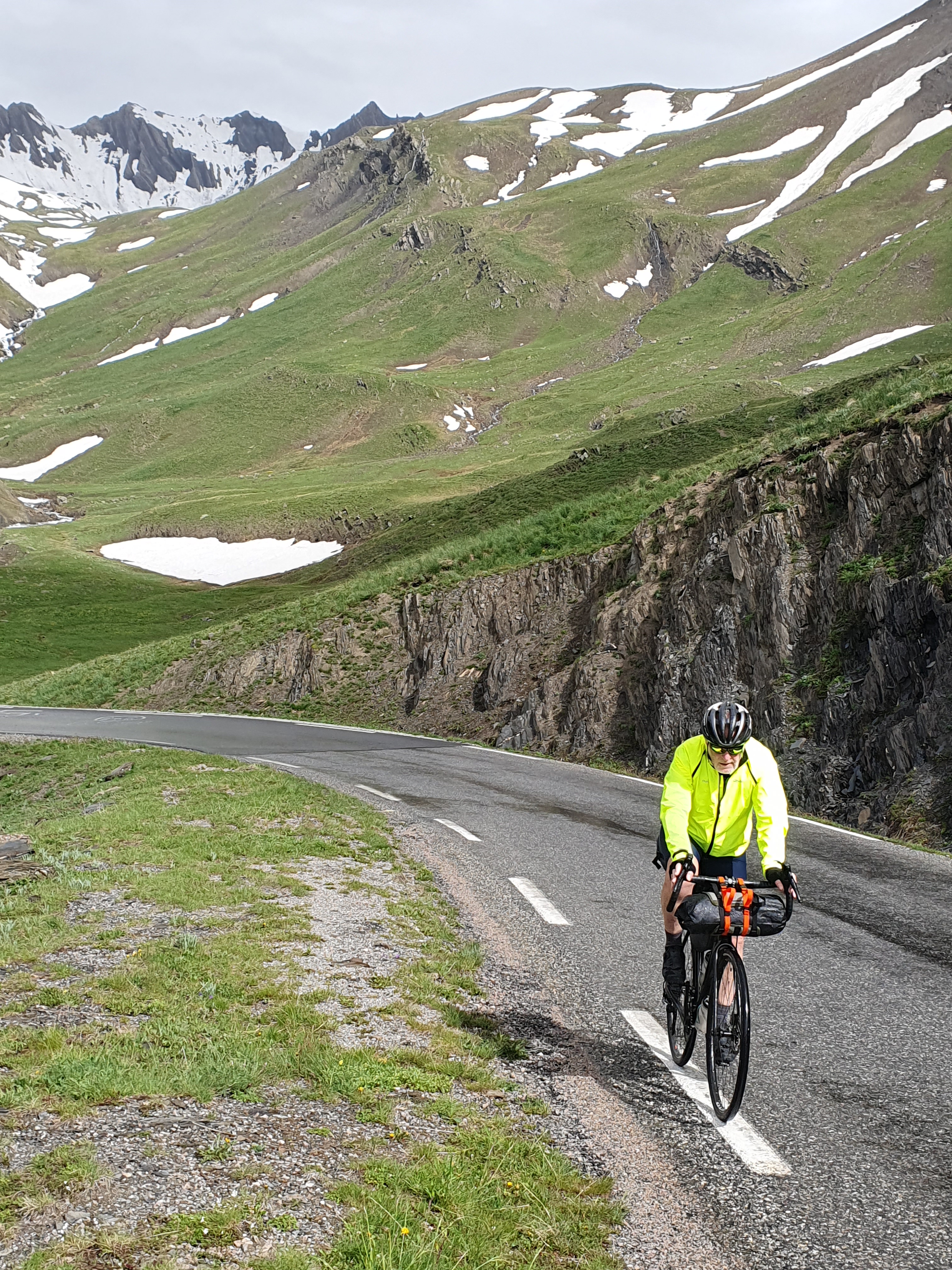
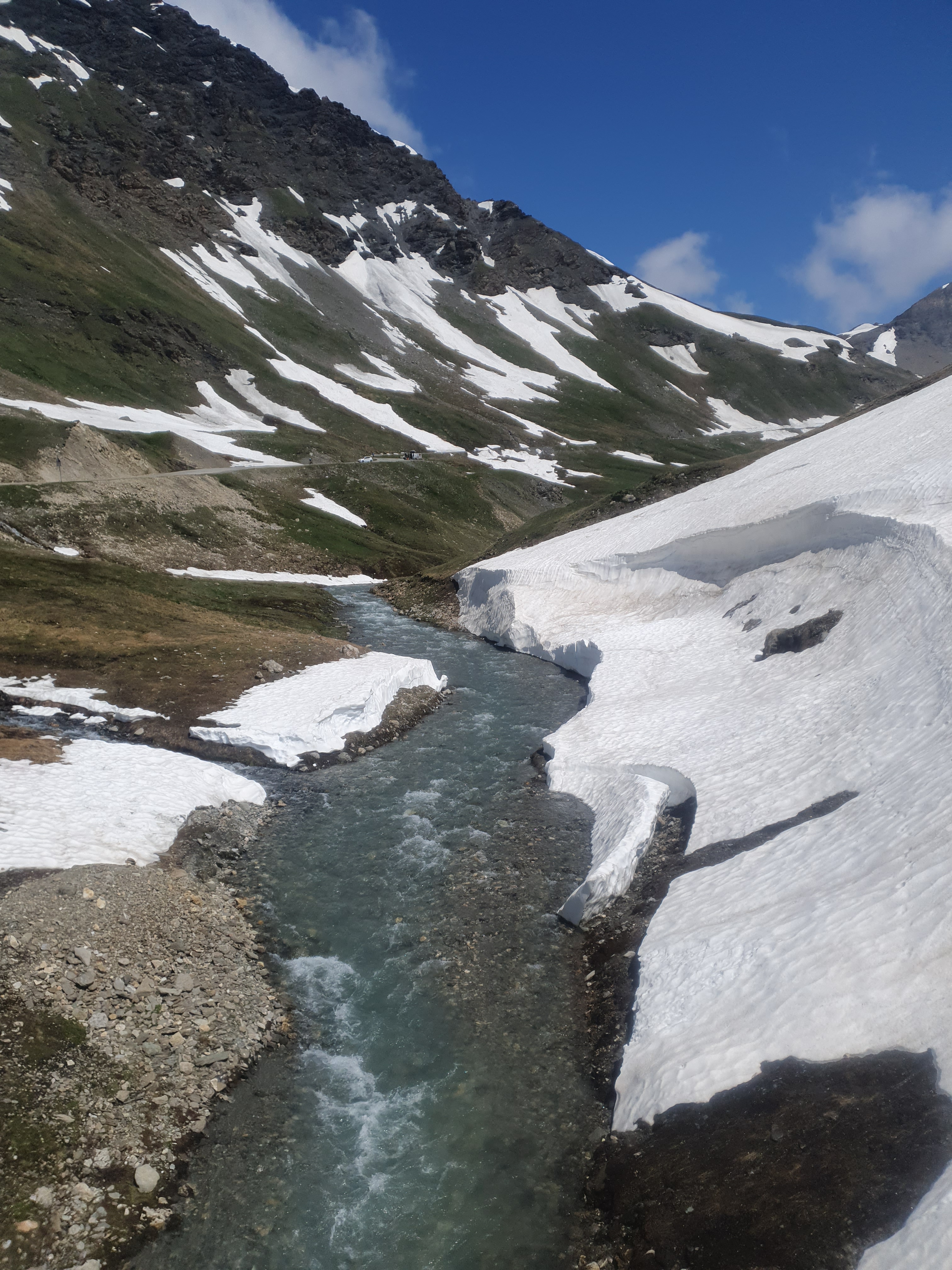
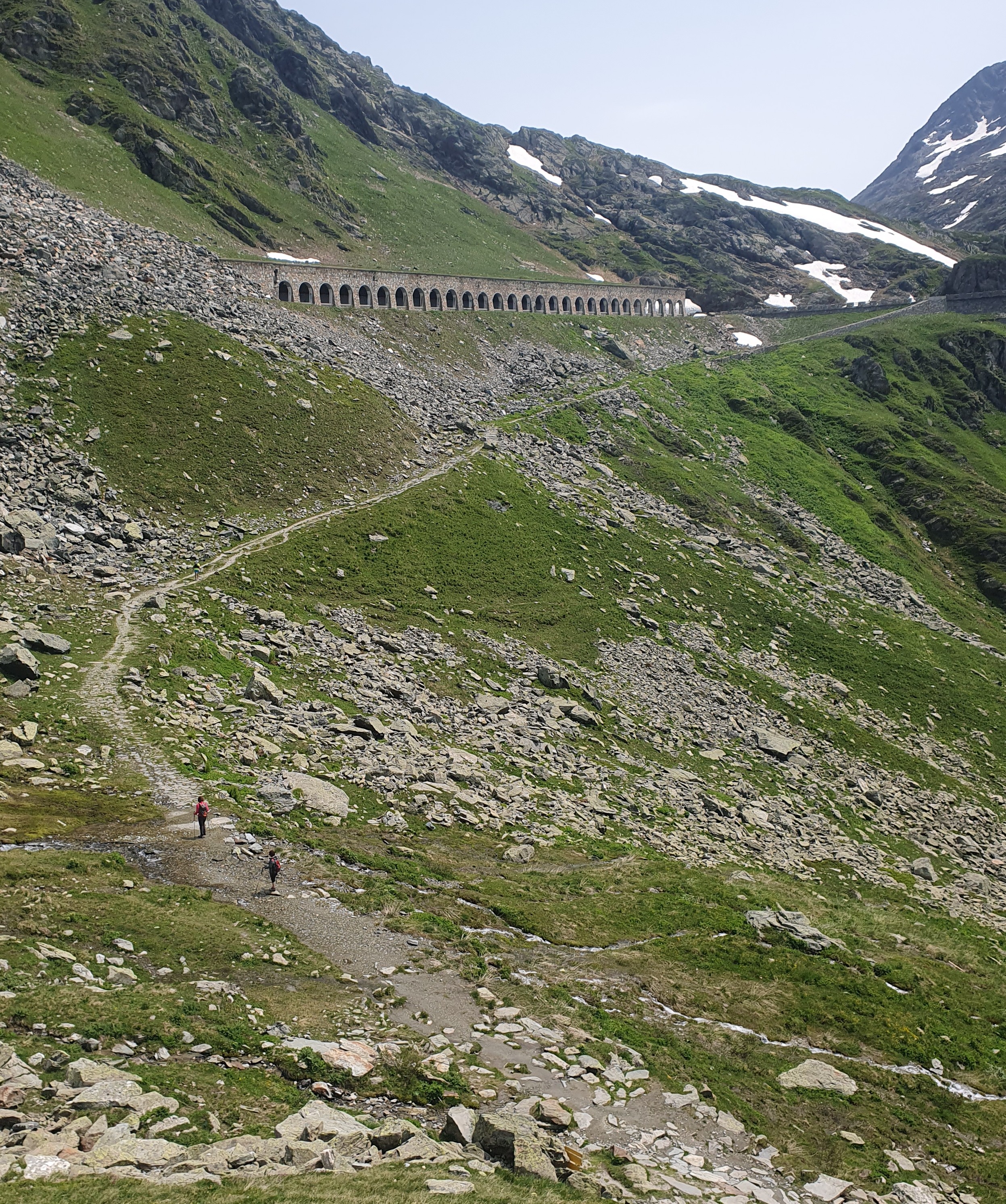
Beyond the last switchback the road climbs back towards the top of the canyon, levelling out as it crosses precipitous slopes and then diving through a tunnel above the gullet. Once through the tunnel we emerge into an upper bowl in the mountains, large drifts still lining its slopes.
The road climbs steadily across slopes for a kilometre or two, ramping steeper and steeper as it goes. I can see some ski infrastructure high above and, presuming that this is the summit, put in extra effort to reach it. Of course, it is not the summit. What I find is
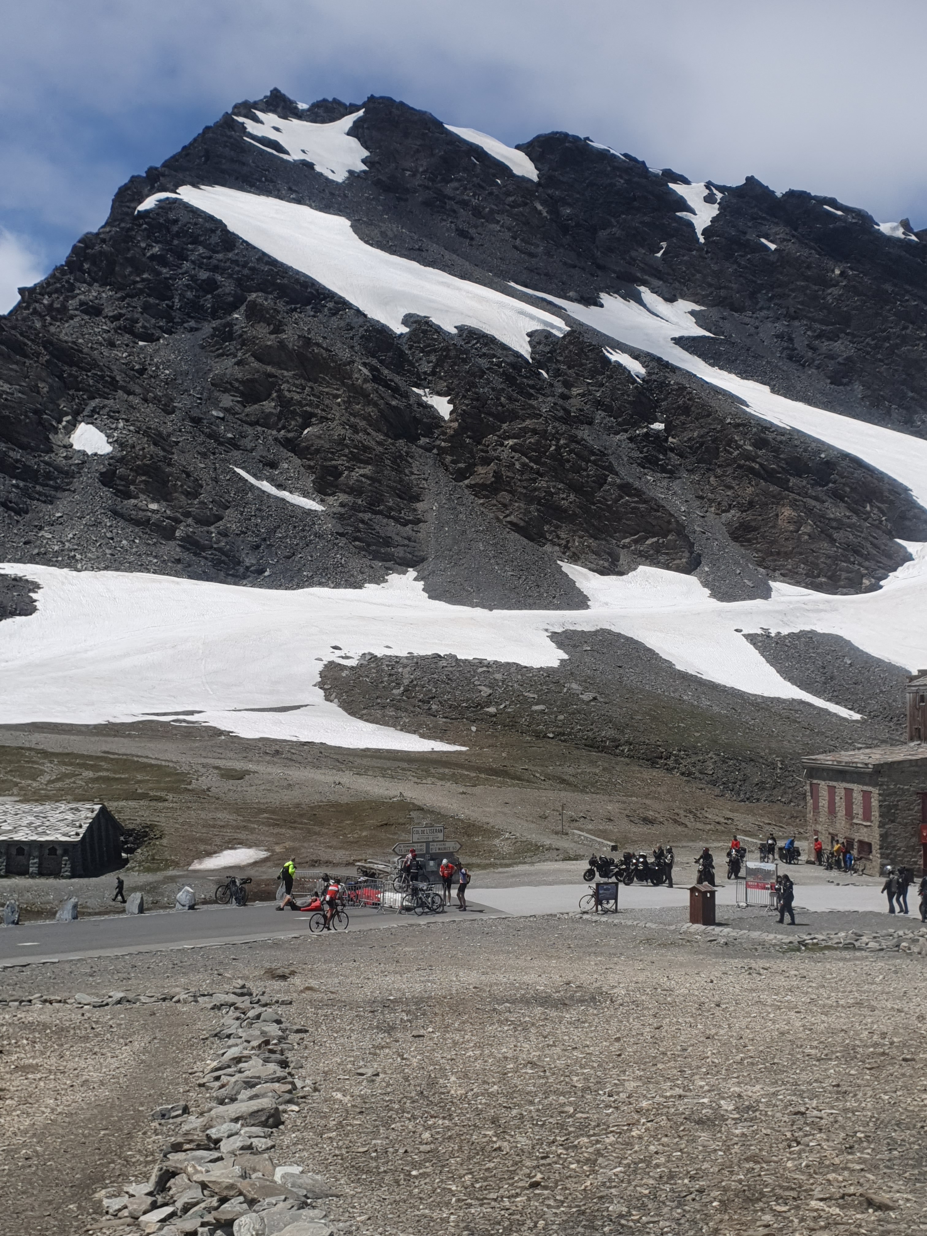
another switchback with the road climbing yet steeper to the left, plus a not very slender cyclist on the verge of a break-down after making the same discovery. But with a bit of encouragement, he keeps going. And around just one more bend we reach the Col.
There’s a big gaggle of cyclists queueing for photos at the summit marker. No Ross. I cruise back down the hill a bit and find him discombobulated by grinding sounds coming out of his bike’s drive train. Certainly, I don’t like the sound of it.
We take a break at the top amid the international masses. There is no obvious cause for Ross’ bike’s noises. Sadly there’s no coffee either. So, whatever, we head down the far side into the Val d’Isere.
It’s a big roll down, through this valley, towards the city of Bourg St Maurice. We have been pondering whether to keep riding and cross the Little Saint Bernard Pass this afternoon but now have to consider what to do about Ross’ bike. The alternative to crossing this second col is to stay in Bourg tonight, hopefully finding some repairs this afternoon, presumably after 16:30, or tomorrow, hopefully before 16:30. However it’s a brand-new bike and Ross concludes it will survive as far as the city of Aosta, in the eponymous Italian valley beyond the Little Bernard. So the Little Bernie it is. Which means we only have to descend the Val d’Isere as far as the 900m contour at Sainte Foy Tarentaise, a little above Bourg, before starting up the next 1140m ascent from there: the Little St Bernard being, actually not so little.
I don’t really want to talk about the Val d’isere. We fang our way through it. It seems to go on forever as just the most appalling example of what the ski industry can do to a beautiful Alpine valley. Once beautiful valley that is.
It’s bloody hot at Sainte Foy. The sun is beating down. My water bottle is empty. We start up the interminable switchbacks of a short-cut, grinding it out with sound effects courtesy of a certain bike. That said, we do find ourselves back in a beautiful alpine landscape on a quiet, minor road, the ski resorts left behind and the heat not-withstanding.
We reach the main road from Bourg to the Col sooner than intended having missed a turn off among the many switchbacks below. But the bigger road is also more gradual and again I lose count of the soporific sets of hairpin bends that separate us from La Rosiere, a not-so-bad ski village that marks the transition from pine forest to alpine upland.
It’s turning to evening by the time we get there and sit outside the small supermarket with a cold drink. Should we camp somewhere up at the Col or roll straight down the far side of the mountain to La Thuile, in Italy? We can’t make up our minds and decide to leave it to Saint Bernard to decide when we reach the top.
From La Rosiere the road climbs slowly as it traverses a slope towards a large valley to the west.
The Little Saint Bernard is unusual in that once the road has swung around into this upper valley, you get a good view of the col you’re heading for, even though it’s still fully five kilometres away. The problem is that no matter how many times you look up from your labours, it never seems get any closer.
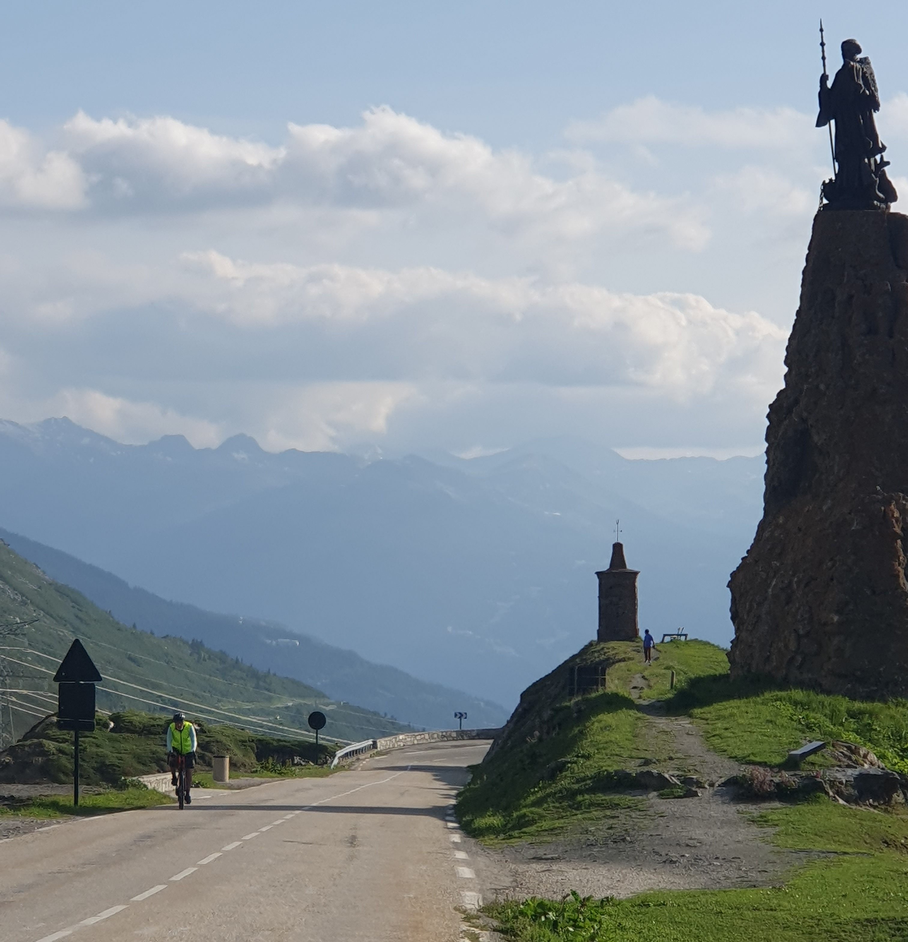
Nonetheless, eventually rounding a couple of final bends I put in a final effort and pass through the shade of the titanic St Bernard himself, then pull up at the equally impressive concrete edifice of the Auberge de l’Hospice du Petit Sant Bernard. Getting off the bike I can’t believe that we hadn’t considered the prospect of staying here, at this refuge. Wandering in I eventually find the very efficient French speaking lady who runs the place and get a run-down of facilities and prices. Heading back out, Ross is clanking mightily as he passes below the imprecations of the towering Saint. He pulls up and needs no sales pitch, the Refuge it is!
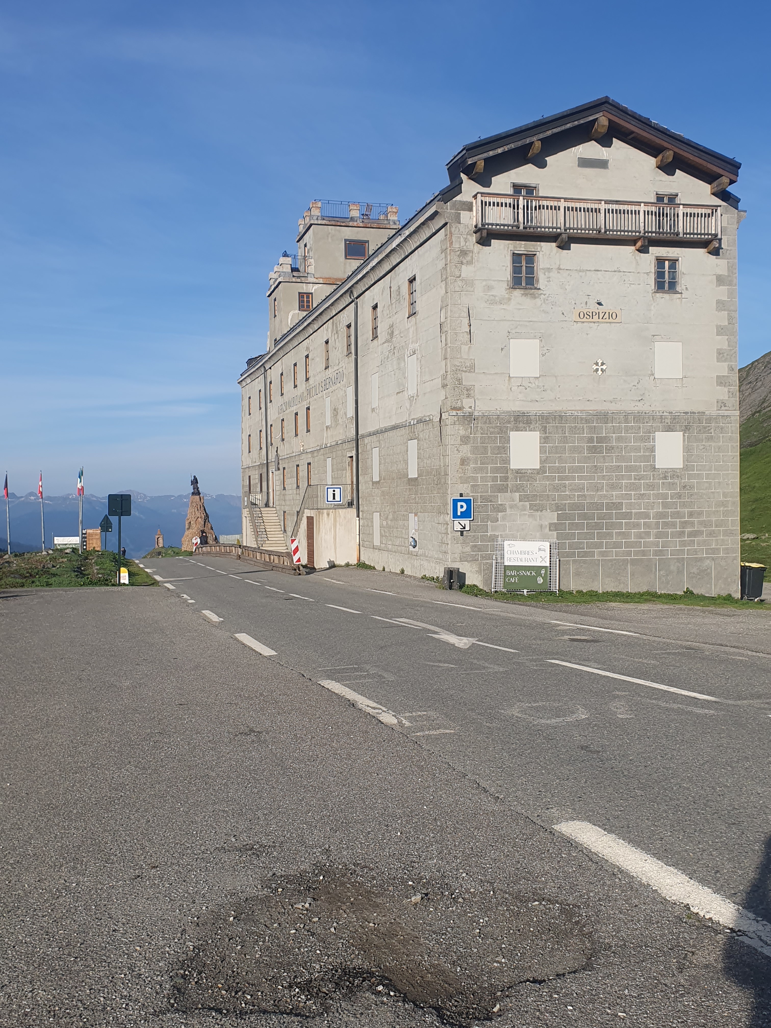
It turns out they have a visiting chef from Nepal (yes, I had understood that correctly) and what a fantastic meal we have. The staff, chef included, are lovely friendly people. Wine, beer and meal economical, and we get a bunk room to ourselves.
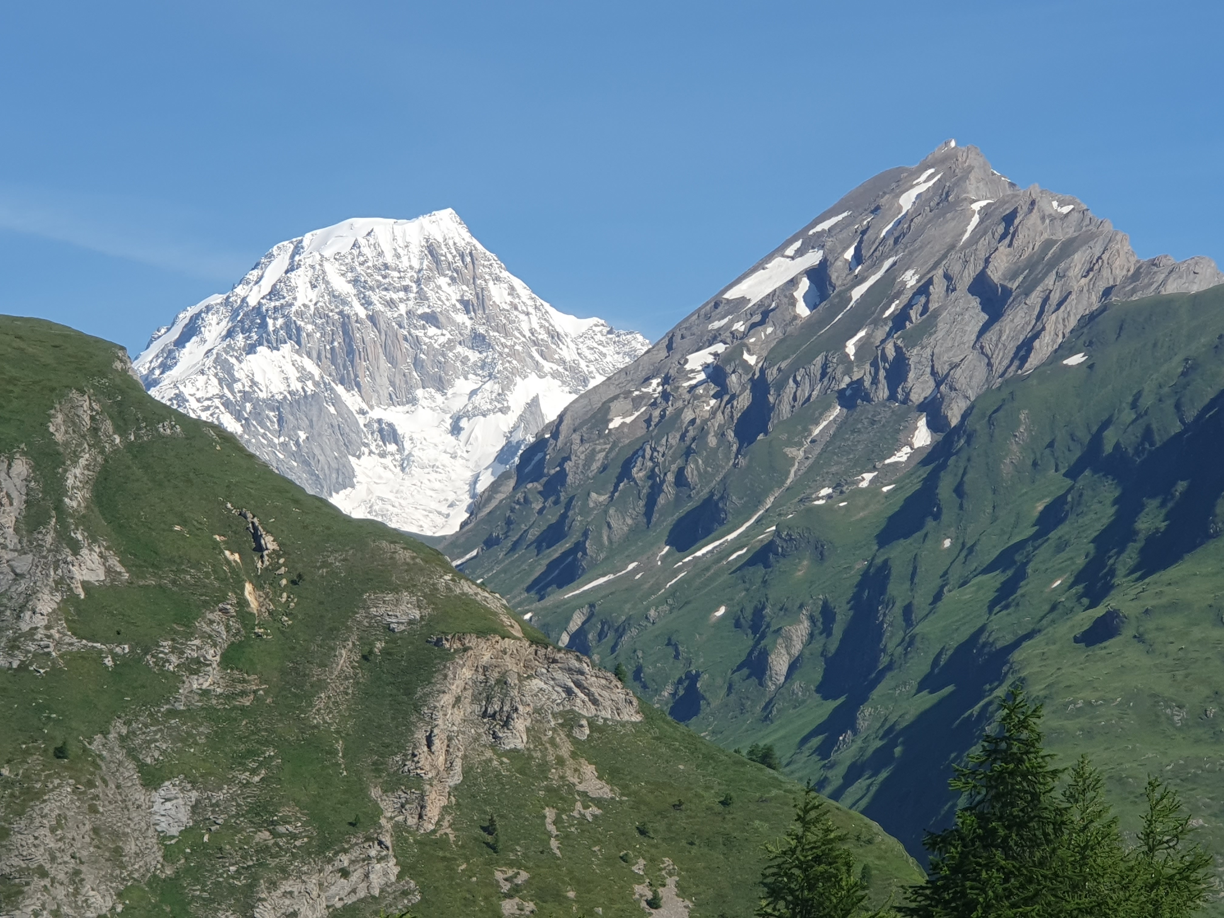
To top things off, in the morning we have a rest day in front of us. All we have to do is hoon down to Courmayeur, a resort town at the head of the Aosta Valley, nestled far below at the base of Mont Blanc.
The hooning goes very well. The last time I rode down here I stopped for the night in La Thuile. So doing the hill from top, 2188 metres, to bottom at one thousand, is a treat. The road is in better condition than last time as well.
We hit the River Dora Baltea at a place called Champex, turn left upstream and start riding up to Courmayeur, which is a nonstop uphill. It’s bloody hot down here. Once there, and a bit sweaty, we go into the tourist office to get the low down on campsites. Though lowdown’s not the right word because the campsites, it seems, are all way above us, even further up the valley.
Outside, Courmayeur is baking. Yet the place is thronging with well-dressed people, all looking cool and leading, or being led, by dogs, most of which are even better groomed than their humans. I start to feel like I don’t fit in. And looking at Ross, he definitely doesn’t. A couple pass, pushing a posh-looking pram. Being a grandparent, I peer in to cootchy-coo the baby. But there’s a cat in there, staring back out of its flat, blank face. I look up at the proud parents: they bear the same expression. Hmm. We get back on the bikes and clank on out of there, uphill.
There is a bar-come-restaurant where we find some expensive food and a welcome cold beer for lunch, but then it’s unendingly steep up through Entreves to the Campground Grande Jorasses, a pleasant enough destination amid the pines at 1600 metres. Cooler here too, but Ross and I agree, we just have to stop having rest days like this.
We spend the next day doing the tourist thing, riding the Funivie Monte Bianco, a cablecar, up to the glacial flanks of Mt Blanc, at 3400 metres, which is quite spectacular.
Another night at the Campground Grande Jorasses and we’re away again, studiously avoiding any references to having a rest. Although the fact is we’re only heading for the city of Aosta, a mere 44 kilometres away and 1100 metres lower. There we hope to effect some repairs to Ross’ bike.
It’s an easy, often spectacular and very quick ride.
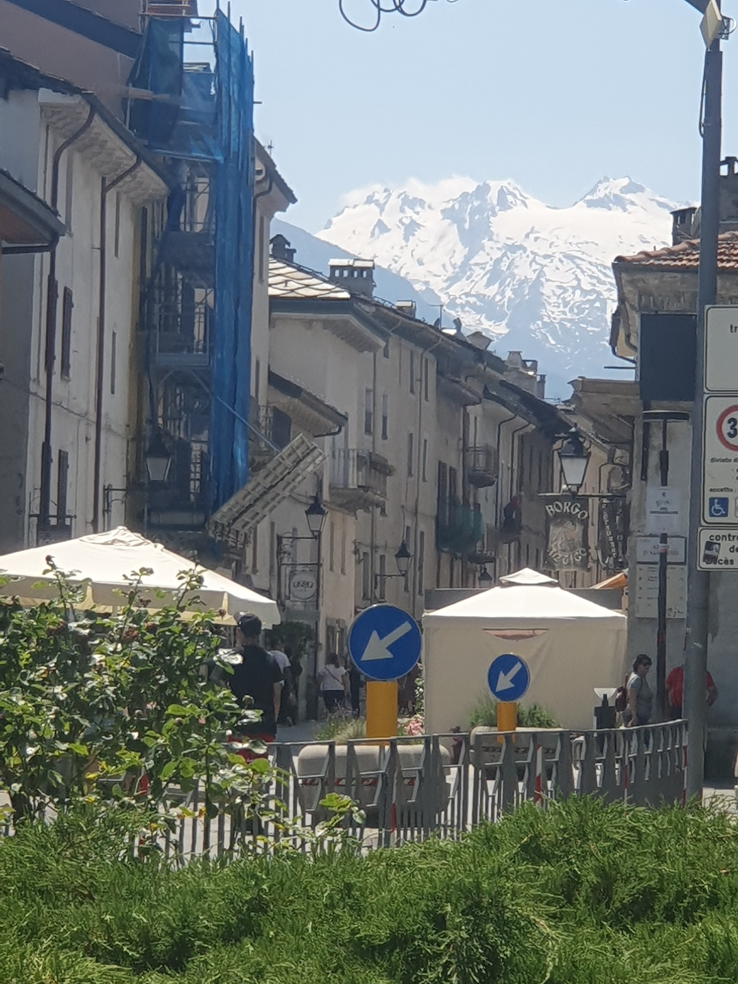
We pull up on the edge of the old city and get a couple of coffees in an adjacent bar. Small is beautiful when it comes to cities and Aosta fits that bill, and the friendly demeanour of the waitress reinforces what a pleasure it is to be back in Italy. We book a place online to stay for a couple of nights. It turns out to be just around the corner, but first we have to get the bike fixed.
We light on Bike Hub Aosta which is across the river but not too far off. After a bit of blundering around we find the place and, yes, English is okay. Furthermore they’re happy to look at Ross’ bike as soon as he can get all his gear unloaded. Given how unpleasant the drivetrain grinding noises have been, we’ve arrived not knowing if we’ll have to leave the bike or whether a prompt fix can be effected, given how new but previously unserviced it is. Thankfully it turns out to be the latter. As well as efficiency, the Bike Hub has a proper sit-down cafe attached to it so we relax and catch up with breakfast.
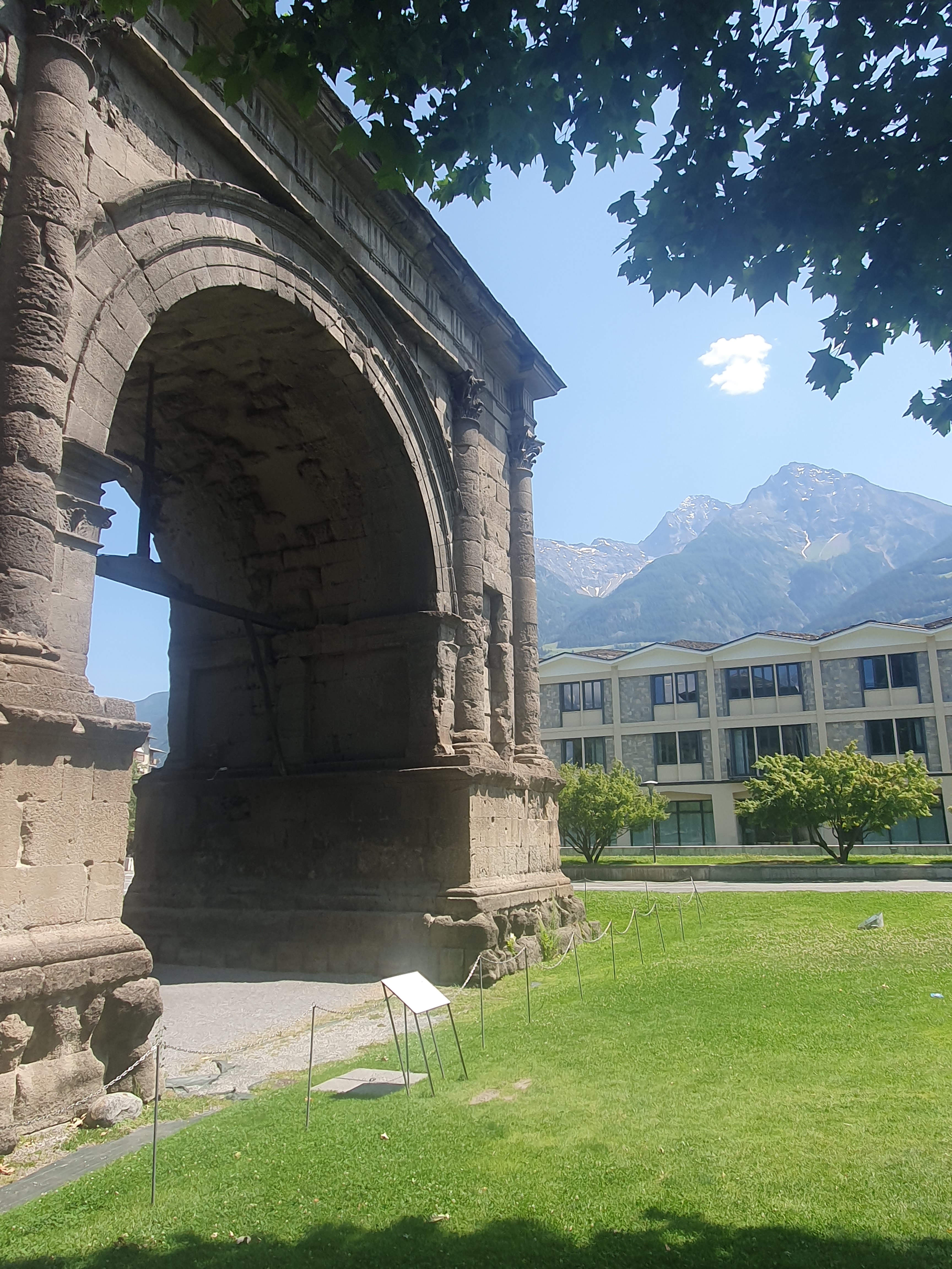
Given that both the city and valley of Aosta are named after Augustus, the final wrecker of the Republic and subsequently first Emperor of Rome, we cruise (now silently) down to check out the Arch of Augustus, an
impressive triumphal arch dating to the year 25 BC, plus the nearby Porta Pretoria which was the equally imposing gateway to the ancient city. Then, after a gelato and a snooze in the shade, bump down the cobbles of the old town’s main street to check out our lodgings.
We find the place, it’s facade a blank on the narrow street, search our way into it via a dark alley and gloomy archway, through an echoing courtyard and up some flights of stony stairs. And for all the age of the building it’s in, what a fantastic apartment it turns out to be. Ah, Italy!
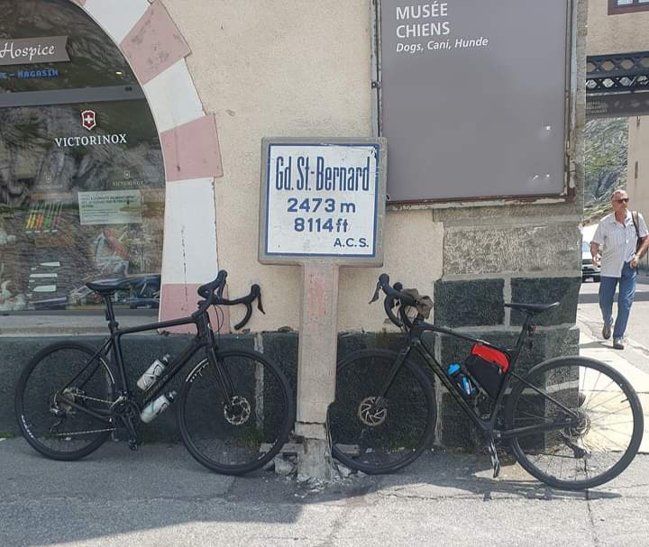
And for tomorrow, the Great Col of Saint Bernard.
The town sits neatly contained within the 600metre contour, the Great St Bernard stands at 2469. Only 32 kilometres distant, the height gain involved in riding it is 1878 metres. So a substantial climb. It’s hot and sunny by the time we set off.

The climbing starts straight out of town and never really stops. There are a couple of kilometres of very gentle slope before Etroubles, this being a village about half way up, not a condition relating to your GPS, but in general the slope is good and steady between 5% and 8%. This is a major route connecting the Aosta Valley and the upper Rhone in Switzerland, above Lake Geneva. There are good verges though, and the road splits at a high bridge a few kilometres after Etroubles, with most through traffic diverging onto a dedicated road that dives, higher up, into a 3 or 4 kilometre tunnel under the mountains. As far as this junction the road is scenic enough, but above, really quite beautiful. Also, less put upon by traffic.
Climbing steadily through a beautiful pine forest we reach the 1800 metre contour before emerging into a broad valley of alpine grassland and traversing, less steeply now, to the base of the final climb.
At this point there’s a modest fromagerie offering coffee and snacks. Ross and I have been riding at our own pace so I pull over and wait with a good view up towards the top. There’s a road gallery just visible way up there and I’m pretty sure from memory that the summit lake is just around the corner from it.
Caffeinated and refuelled we set off again and I decide to really put some effort into these last few kilometres.
It’s a perfect day up here above 2000 metres, all the heat and traffic of the valley below us, and I work into the cadence of effort versus movement, distracted only by the beauty around me.
Higher still the road passes around the back of an embayment in the hills and I can look across to what is obviously the remains of the road the
Romans built to utilise this pass, which they called Poeninus Mons. The road gallery I’d seen is drawing near so I increase my efforts.
Through the gallery and around that last corner I find, not triumph, just yet more hill climbing steeper than ever, onwards beyond sight. Thought I would’ve learned by now.
Dropping back onto the bike seat I slow down till my breath catches up with my legs, then press on uphill at a more sensible rate. After two or three kilometres the lake finally does appear and, rounding it, one more small rise to the Hospice du Grand Saint Bernard, which sprawls exactly across the summit. A stone’s throw down the other side, in Switzerland, is a cafe. I cruise down, order some lunch and wait for my friend.
It’s taken us 3 and a half hours to ride up here. It takes us 48 fun-filled minutes to get back. In the afternoon we check out Aosta’s Roman theatre then check into a restaurant for dinner.
Morning has us reluctantly packing but, loathe to leave the Aosta Valley, we decide to ride up another side valley to the town of Cogne, have a look at the Gran Paradiso National Park and camp up there. We can think about starting back for Turin tomorrow.
First we have to cross the valley floor through endless, impeccably neat vineyards. Reaching the mouth of the Val di Cogne (or Val de Cogne if you prefer, both French and Italian being commonly spoken in the Aosta) at Aymavilles we start the ascent, compared to yesterday a comparatively modest climb of 1150 metres over maybe 20 kilometres.
It is a good road with not a lot of traffic, but the ascent never leaves the containment of the valley and as such is less interesting than what we’ve grown accustomed to. There is beautiful forest and the occasional pasture. At one point we intercept a herd of rambunctious cows staging a breakout from their electric fence, down onto the road. Heading down to the adjacent hamlet, we raise the alarm. There is a waterfall, quite a few tunnels, the occasional day-tripping cyclist passes us.
Cogne itself is a small place with views up into the Gran Paradiso. At 4061 metres the mountain is the highest peak wholly within Italy, the name being derived from a corruption of Aostan French, Grand Parei, or great wall.
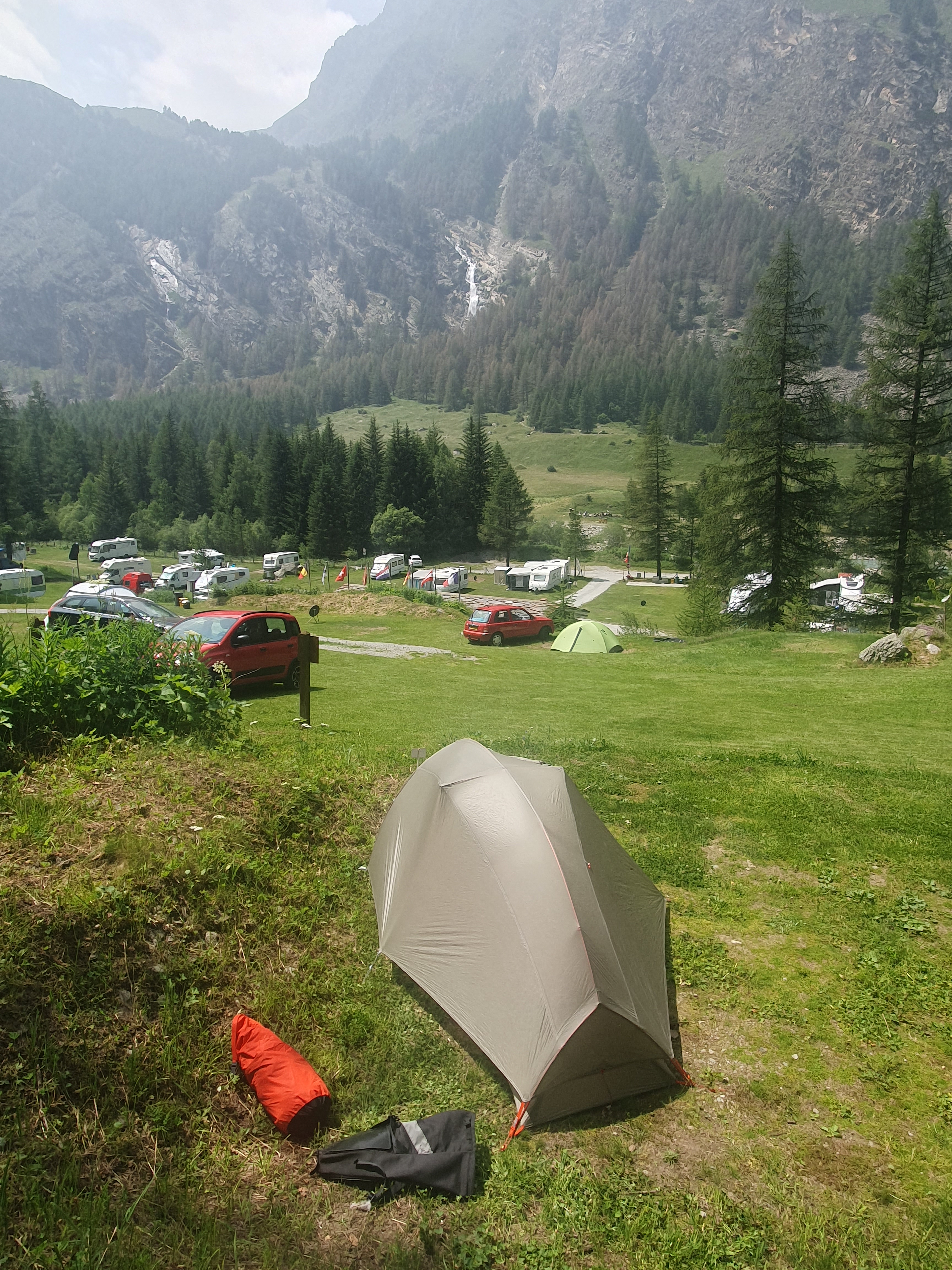
After lunch we ride further up-valley and pitch the tents at a scenic campeggio. There are a number of walkers and alpinists staying there and I envy their journeys up towards the greater heights.
It is however sad to notice a lot of pine die-back on the slopes opposing the campground. Apparently many of the greater Aosta’s Scots Pines have been suffering high mortality and are even beginning to die out altogether at some altitudes. The causes aren’t wholly understood but include increased summer temperatures, drought and increased attack from wood eating insects.
Shaking dew off the tents in the morning, we’re quickly packed and ready to go and it’s a swift descent back through the tunnels, past the cows, indignant behind their fence, and on to the vineyards and

orchards that line the valley around Aosta. Turning right we pass below the intriguing Castle of Aymavilles, follow some terraces and drop down to the valley floor to pick up a bike trail along the south bank of the river, thus altogether avoiding the city. The path is reasonably new, well made and a great development. After a dozen or more kilometres of this pleasantness we’re just settling in, when the path crosses the river and disappears beside the SS26, at Nus.
The SS26 is the valley’s major road, autostrada excluded. With the traffic rushing past it’s certainly less pleasant than the bike path, quite often even lacking a verge. That said, you can keep up a good speed, the lanes aren’t narrow and, Ross and I both observe that here, and in fact for the entirety of our trip, we encounter no threatening behaviour or acts of rudeness from the passing traffic. Courtesy, yes, bizarre aggression such as one occasionally encounters in Australia, not once.
The weather forecast for today is not great and we have 105 kilometres to ride, all up. There’s a lot of downhill but we work hard and travel fast until the wind gradually picks up and, gusting hard in our faces, slams our progress back into fits and starts.
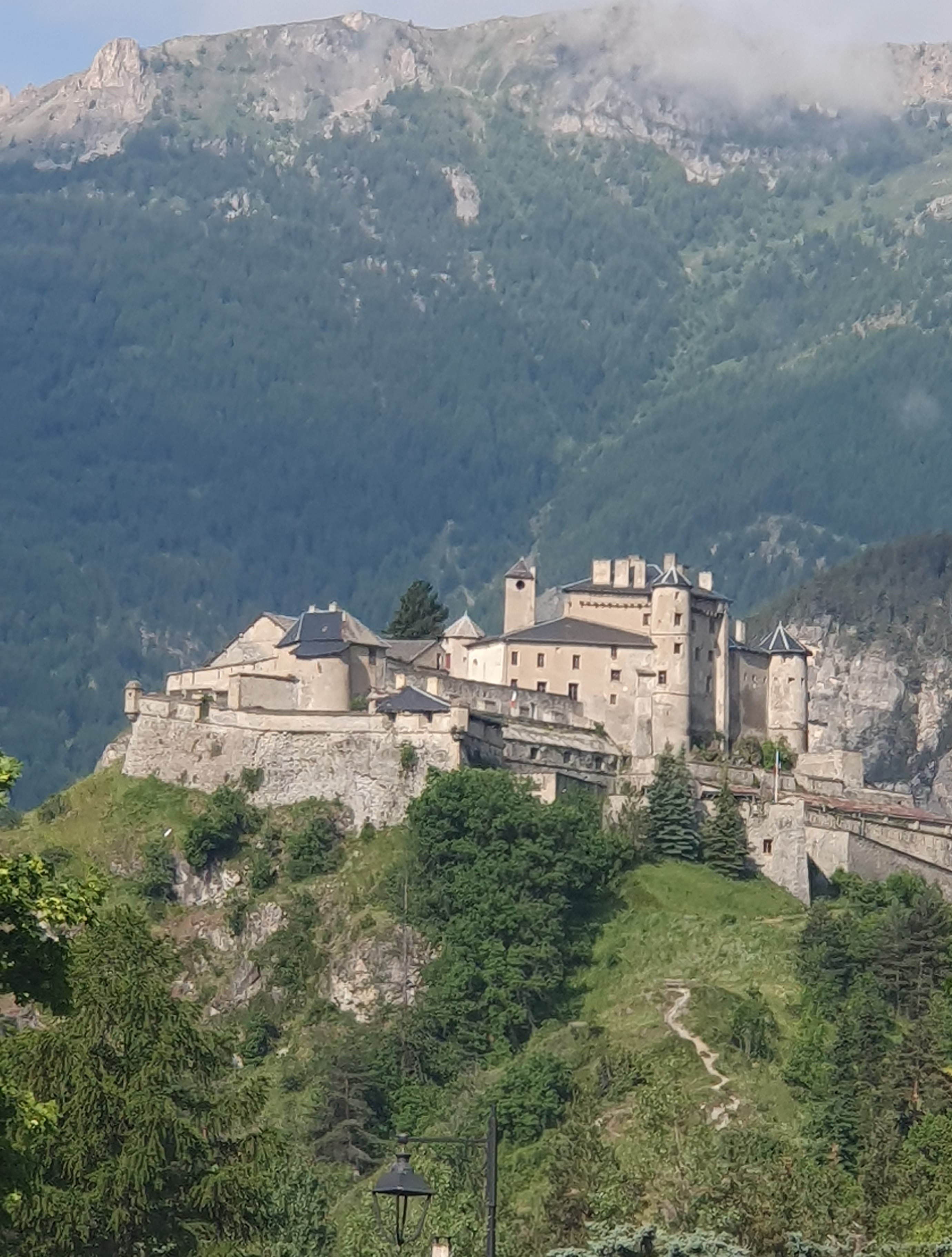
We stop for lunch at Verres. A little further on, the mighty valley narrows to a gorge, though thankfully the wind has eased somewhat. We stop for the obligatory photos of the fortress at Bard, the current
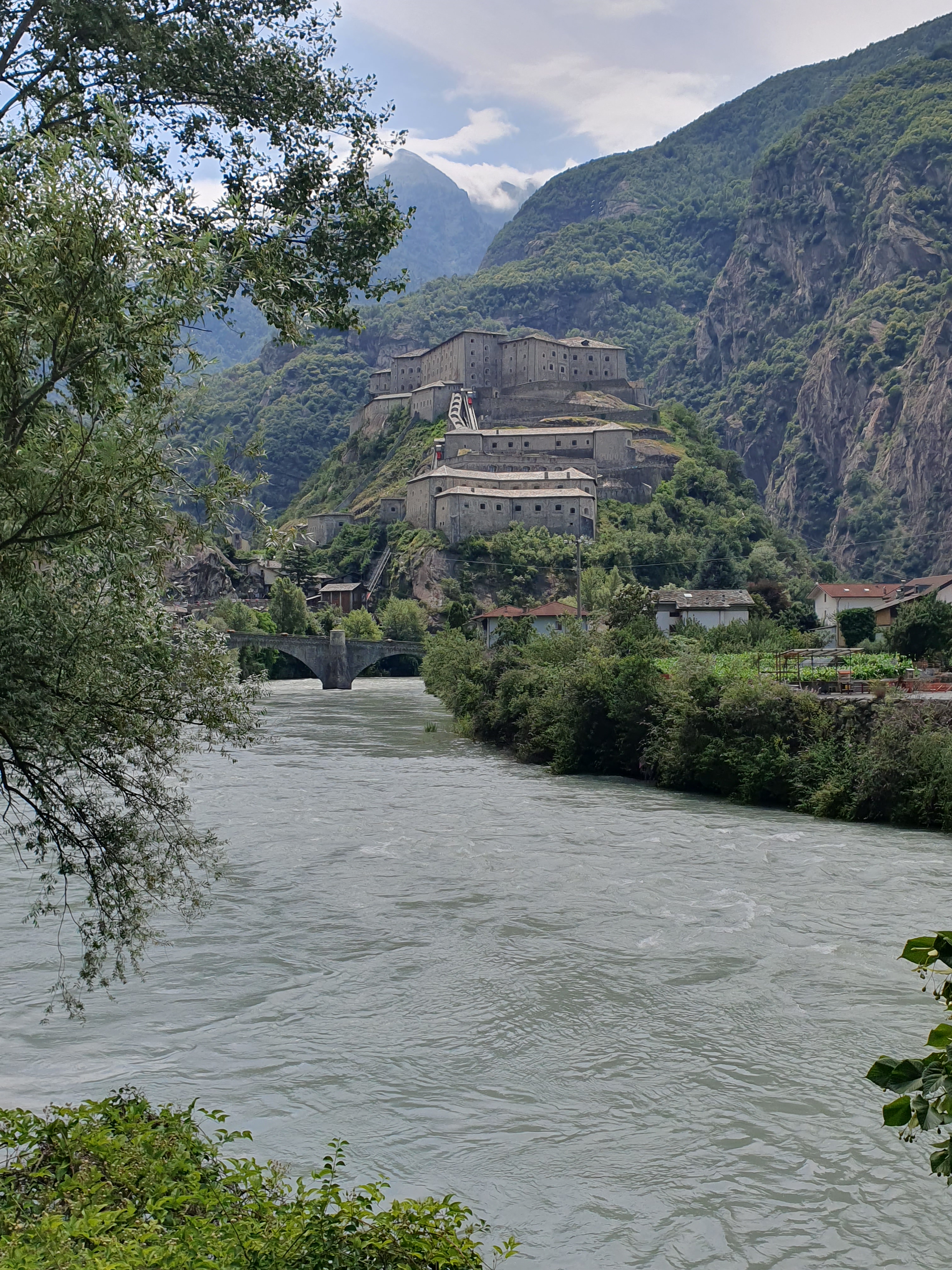
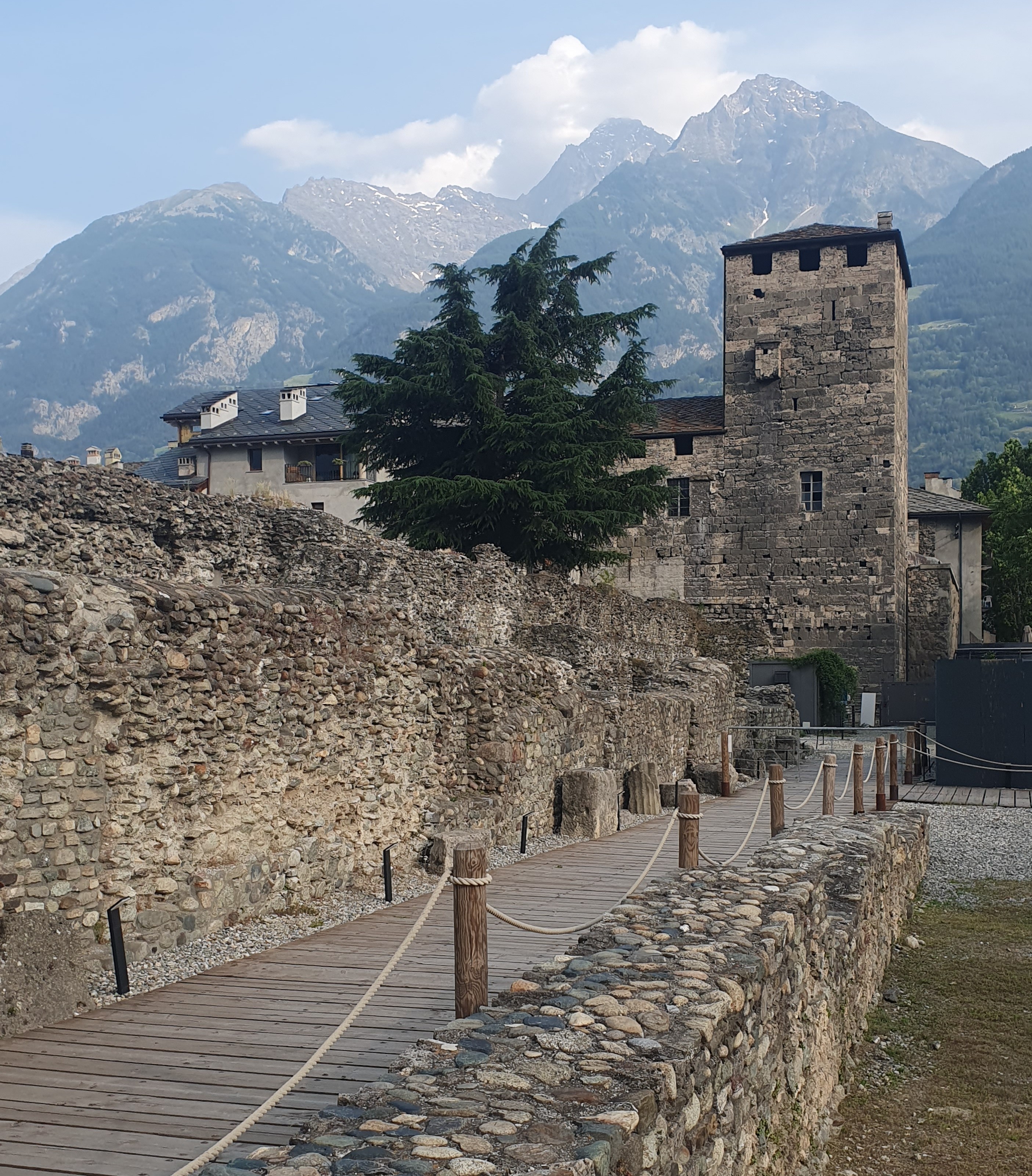
incarnation of which dates back to the 1830s, again built by the Savoys to keeping those Frenchies out, though this same strategic site has been continuously fortified since the 5th century.
Not far downstream is Pont Saint Martin where we take a diversion to see the bridge that the town is named after.
Well worth the visit, this elegant structure is another product of Roman engineering from the first century BC, still standing fast on its foundation of bedrock, looking as strong as the day it was built.
Within the hour we are bumping our way across the cobblestones of Ivrea, sadly leaving the Aosta Valley behind us. Keeping going, we cover a few more kilometres of greater Po plain before stopping at a hotel in a village in the farmland.

There’s only 65 kilometres left between us and where our journey began, through the flatlands, then the teeming traffic into beautiful Turin. Tomorrow.
Top of Form
Bottom of Form
Top of Form
Bottom of Form
